

In the southwestern waters of Việt Nam, the Baseline Marker A1 stands solemnly on Hòn Nhạn Island, part of the Thổ Châu Archipelago. For many Vietnamese people, having the chance to set foot on Hòn Nhạn and stand respectfully before the marker bearing the symbol A1 is a deeply meaningful aspiration—not only because of the challenging journey, but also because of the sacred significance it carries for the nation’s maritime sovereignty.
Marker A1 is the first of 11 baseline markers used to determine Việt Nam’s maritime baseline for measuring the breadth of its territorial sea. It is not merely a legal reference point on the maritime map, but also a symbol tied to nearly 250 years of history, tracing back to the southern expansion during the era of the Nguyễn Lords.
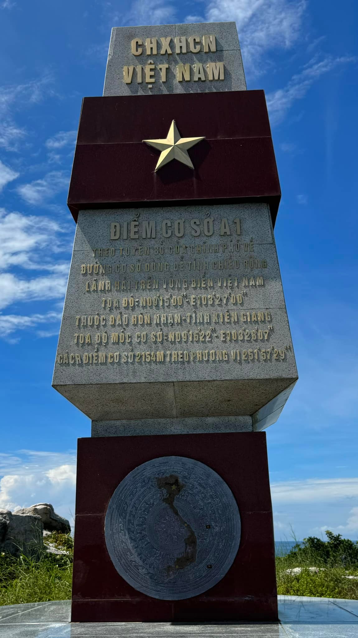
Legal Inscription on Baseline Marker A1
On the eastern face of Baseline Marker A1, the engraved inscription remains clearly preserved to this day:
“Baseline Point A1 according to the Government’s declaration on the baseline used to measure the breadth of the territorial sea of Việt Nam.
Coordinates: N09˚15’00” – E103˚27’00”, located on Hòn Nhạn Island – Kiên Giang Province (now An Giang Province, Việt Nam).
Baseline marker coordinates: N09˚15’22” – E103˚28’07”, located 2,154 meters from the baseline point at a bearing of 251˚57’29”.”
Though these figures may appear technical, they form a crucial legal foundation for defining Việt Nam’s territorial sea, internal waters, and sovereign rights in the southwestern maritime region.
Historical Imprints from the Nguyễn Lords’ Era
According to the book “History of Thổ Chu Island Commune” and other historical records, prior to 1783, Nguyễn Ánh (later Emperor Gia Long) had visited the Thổ Chu Archipelago multiple times during his years of struggle and consolidation of power.
In 1956, the Saigon administration erected a marker on Thổ Châu Island engraved with the name Poulo Panjang—the Western name for Thổ Châu, meaning “Long Island.” Before 1975, Thổ Châu was home to around 500 residents.
Historical Tragedy and the Return of Thổ Châu’s Residents
Following the tragic events in which the entire civilian population of Thổ Châu was abducted and massacred by the Khmer Rouge, the archipelago remained uninhabited for a long period. On April 27, 1992, the People’s Committee of Kiên Giang Province launched a resettlement program, bringing residents from the mainland back to Thổ Châu and gradually restoring life on this frontline island commune.
In 2017, Baseline Marker A1 was officially constructed on Hòn Nhạn Island, marking the first point in the system of 11 baseline markers defining Việt Nam’s maritime baseline.
Hòn Nhạn in the Memories of the First Settlers
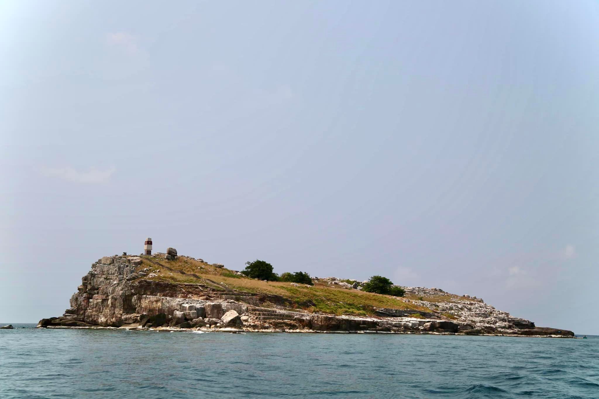
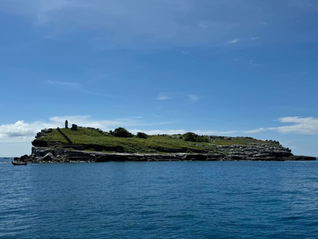
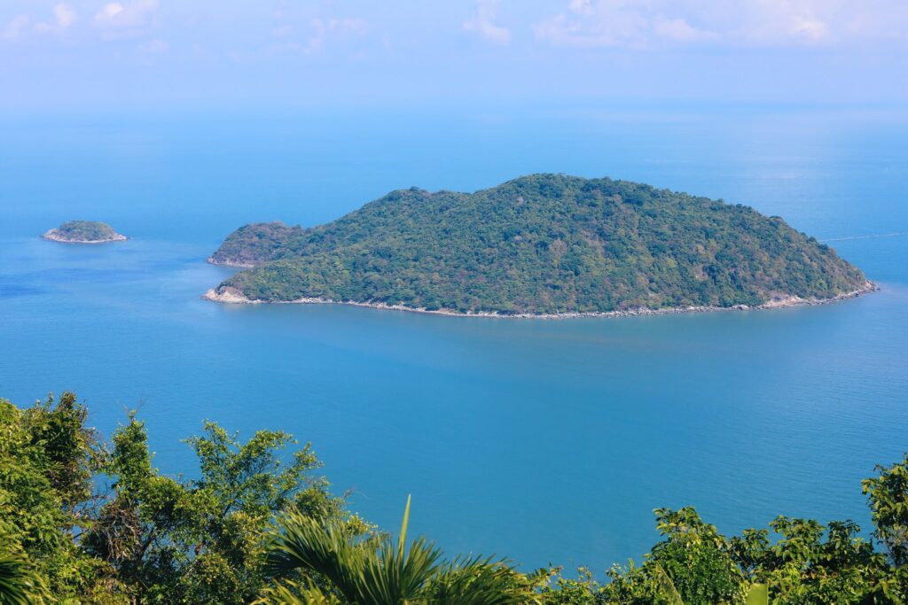
Hòn Nhạn is a small island, covering only about 3–4 hectares. The island consists almost entirely of exposed rock, with very few cracks where vegetation can take root. In some natural depressions along the slopes, layers of dry leaves and decayed grass have accumulated over time, forming thin patches of soil capable of supporting only a handful of drought-resistant plants.
Ms. Tăng Thị Phượng, one of the early settlers, recalled that those who first arrived on Hòn Nhạn were often astonished by the stark landscape. Yet their longing for the mainland gradually faded as flocks of terns filled the sky, their calls echoing across the island, creating the feeling of entering an entirely different world.
Holding on to the Island Amid Hardship and Scarcity
When the first settlers arrived to establish their lives on the island, surrounded by vast seas, the most pressing question was simply: “Where will food come from?”
Mr. Nguyễn Thái Học (born in 1954), the first Chairman of the Thổ Châu People’s Committee, recalled that the waters around Hòn Nhạn were once teeming with fish.
The residents caught fish and dried them for consumption, as the distance to the mainland was too great and transportation extremely limited—there were only a few small boats and no supply vessels. At times, people even traveled to Hòn Nhạn to collect bird eggs to supplement their daily meals.
During periods of rough seas when fishing was impossible, residents returned to the main island to hunt water monitor lizards, a reptile similar to sea iguanas but larger, to get through the hardest days. When the sea calmed, they ventured back to Hòn Nhạn, watching birds fill the sky and quietly longing for the mainland.
As living conditions gradually improved and regular transport links were established between Phú Quốc and Thổ Châu, local authorities advised a ban on collecting bird eggs in order to protect the island’s characteristic seabirds and fragile ecosystem.
Hòn Nhạn – Where Sovereignty Is Guarded Through Resilience
Today, Hòn Nhạn is not only the site of Baseline Marker A1, but also a powerful symbol of the endurance and resilience of the Vietnamese people at the nation’s maritime frontier. Standing before Marker A1, amid salty sea winds and the ceaseless rhythm of waves, one can more clearly sense the value of every stretch of sea and every fragment of land—values forged through history, sacrifice, and the quiet perseverance of generations who have remained steadfast on these remote islands.
For many, Hòn Nhạn is not a conventional tourist destination, but rather a journey of understanding—a place to pause, reflect, and deepen appreciation for the sacred maritime sovereignty of Việt Nam.
