

Following Vietnam’s administrative reorganization in 2025, the country officially established 13 Special Zones (Đặc khu) operating from July 1, 2025. These zones span from the Northeast to the Southwest coast and include:
Cô Tô (Quảng Ninh), Vân Đồn (Quảng Ninh), Cát Hải (Hải Phòng), Bạch Long Vĩ (Hải Phòng), Cồn Cỏ (Quảng Trị), Lý Sơn (Quảng Ngãi), Hoàng Sa (Đà Nẵng), Trường Sa (Khánh Hòa), Phú Quý (Lâm Đồng), Côn Đảo (Ho Chi Minh City), Phú Quốc (An Giang), Kiên Hải (An Giang) and Thổ Chu (An Giang).
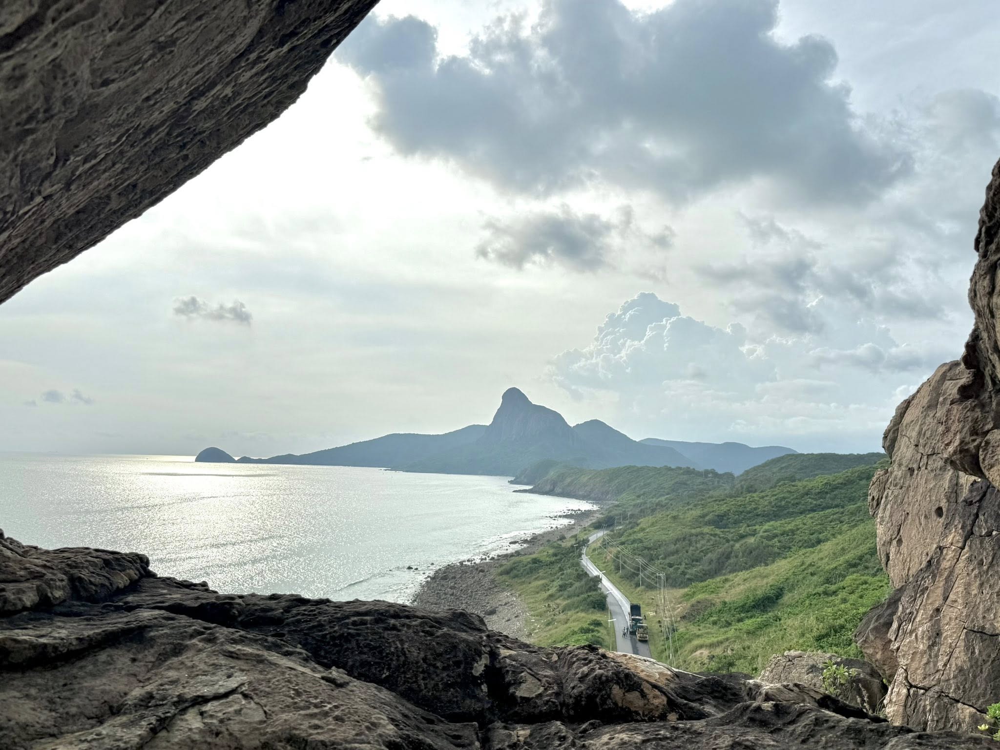
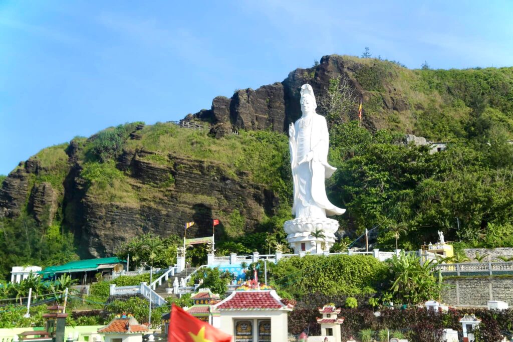
Cô Tô Special Zone
The marine area surrounding Cô Tô covers more than 300 km², offering a pristine natural environment with diverse coral reef systems and rare marine species. As a newly established special zone, Cô Tô is expected to attract investment in sustainable sectors such as deep-sea research, eco-tourism, and offshore renewable energy.
Located along an international maritime route, Cô Tô has favorable conditions for developing logistics services, deep-water ports, cruise tourism, and plays a vital role in safeguarding Vietnam’s northeastern maritime sovereignty.
Historically known as Chàng Sơn, Cô Tô was once a refuge for fishermen in Northeast Vietnam. In 1841, the Nguyễn Dynasty built the Hướng Hóa outpost to combat piracy and protect fishing activities.
By 1954, Cô Tô belonged to Móng Cái district, populated mainly by the Hoa (Chinese Vietnamese) community. However, from late 1978, most of them returned to China, reducing the population to 10% and causing economic decline.
In March 1994, Cô Tô district was officially formed. As of May 2025, the population exceeds 7,000, residing mainly in Cô Tô Town, Thanh Lân, Đồng Tiến and small satellite islands.
From July 1, 2025, the Cô Tô Special Zone was established, covering 53.68 km² of land, comprising 74 islands, bordering China via nearly 192 km of maritime boundary, and owning an abundant fishing ground of over 300 km². With its diverse landscape and strategic defense role, Cô Tô is set to become a leading marine tourism destination in Northeast Vietnam.
Vân Đồn Special Zone
Under the administrative restructuring plan, the entirety of Cái Rồng town and the communes of Bản Sen, Bình Dân, Đài Xuyên, Đoàn Kết, Đông Xá, Hạ Long, Minh Châu, Ngọc Vừng, Quan Lạn, Thắng Lợi and Vạn Yên were merged to form the Vân Đồn Special Zone.
Covering more than 2,170 km² with a population of nearly 54,000, Vân Đồn is Vietnam’s largest island–sea special zone by total area.
With over 600 islands and 481 km² of mainland area, Vân Đồn is four times the size of Cô Tô and encompasses the scenic Bái Tử Long Bay, home to famous attractions such as Ngọc Vừng, Quan Lạn, Minh Châu and Thắng Lợi.
In March 2025, Quảng Ninh launched a sightseeing route through Bái Tử Long Bay, connecting iconic spots like Hòn Mèo May Mắn, Bản Se Island, Nhà Trò Cave, Phất Cờ Cave, the Black Rock Pearl Farm, and Cái Lim Beach.
Major infrastructure projects have reshaped Vân Đồn’s economic profile, including the Vân Đồn International Airport—Vietnam’s first privately funded airport—and the Hạ Long – Vân Đồn – Móng Cái Expressway, which reduces travel time from Hanoi to Vân Đồn to only 2.5–3 hours.
Premium tourism facilities such as Ao Tiên International Port, Wyndham Garden Sonasea, and Angsana Quan Lan Ha Long Bay Resort are transforming the region into a premier island tourism hub.
Vân Đồn’s designation as one of Vietnam’s 13 Special Zones allows strategic projects such as the Vân Đồn Integrated Tourism & Entertainment Complex (casino) to further boost economic growth.
Cát Hải Special Zone
Located southeast of Hải Phòng City, about 30 km by sea, Cát Hải covers nearly 345 km² and includes 388 islands, notably:
- Cát Hải Island – approx. 40 km²
- Cát Bà Island – approx. 144 km² (land area only)
As of December 31, 2024, the special zone has 71,211 residents including both permanent and temporary populations.
Cát Hải features an exceptional combination of forest, sea, limestone mountains, and mangrove ecosystems. It lies at the gateway of the southwestern Gulf of Tonkin, adjacent to Hạ Long Bay, forming a unified ecological region.
Key Highlights
- Cát Bà Archipelago: 366 islands; UNESCO Biosphere Reserve (2004)
- Long Châu Archipelago: 22 limestone islets, with the historic Long Châu Lighthouse (built in 1895)
- Lan Hạ Bay: Member of “Most Beautiful Bays in the World” (MBBW) since 2020 and part of the UNESCO World Natural Heritage (2023)
Infrastructure & Connectivity
- Cát Hải hosts some of Vietnam’s most iconic infrastructure:
- Tân Vũ – Lạch Huyện Sea Bridge (15.6 km) – the longest sea-crossing bridge in Vietnam
- Cát Hải – Phù Long Cable Car
- Lạch Huyện International Deep-water Port
- VinFast Cát Hải Automobile Manufacturing Complex
- The 20 km coastal bougainvillea road is celebrated as “the most beautiful coastal route in northern Vietnam.”
Tourism Experiences
- Beaches: Cát Cò, Cát Dứa, Tùng Thu, Vạn Bội…
- Nature & adventure: caves (Thiên Long, Trung Trang, Quân Y), kayaking, diving, trekking
- Local delicacies: grouper, mantis shrimp, tu hài, Phù Long clams, Liên Minh chicken, forest honey, Gia Luận oranges, Hiền Hào taro, and the iconic Cát Hải fish sauce
Bạch Long Vĩ Special Zone (Bach Long Vi Island)
Covering 3.07 km² with about 686 residents, Bạch Long Vĩ is the most remote island of the Gulf of Tonkin, located 110 km from mainland Hải Phòng.
Positioned in the center of the gulf, it lies:
- 110 km from Hòn Dấu
- 70 km from Hạ Mai
- 130 km from Ta Chiao (Hainan)
It plays a crucial role in defining maritime boundaries and is one of the eight major fishing grounds of northern Vietnam. The island supports hundreds of fishing vessels during stormy seasons.
Cultural sites include Bạch Long Pagoda, Trần Hưng Đạo Temple, a memorial to martyrs, and the Youth Flagpole.
Since 2020, the Hoa Phượng Đỏ ferry has operated three trips per month, reducing travel time to just five hours, improving living conditions significantly.
Today, Bạch Long Vĩ is both a vital economic–defense outpost and a promising site for future investment in essential infrastructure, renewable energy, and logistics.
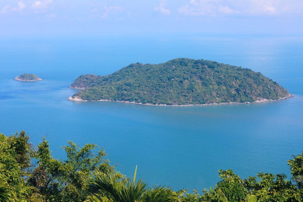
Cồn Cỏ Special Zone (Con Co Island)
Established on July 1, 2025, Cồn Cỏ Special Zone covers 2.3 km² with nearly 500 residents, many of whom are military forces and young families developing the “Youth Island” model.
Located at the southern gateway of the Gulf of Tonkin, Cồn Cỏ is a key defense point with rich marine biodiversity. Formed by volcanic activity over 40,000 years ago, the island features basalt cliffs, coral–shell beaches, and clear waters.
As a volcanic island resembling a giant turtle from above, Cồn Cỏ is rich in history—serving as a “steel shield” during the resistance war and lying within the 9,000 km² Con Ho fishing ground.
The island is expected to benefit from sustainable development in eco-tourism, marine research, and fisheries.
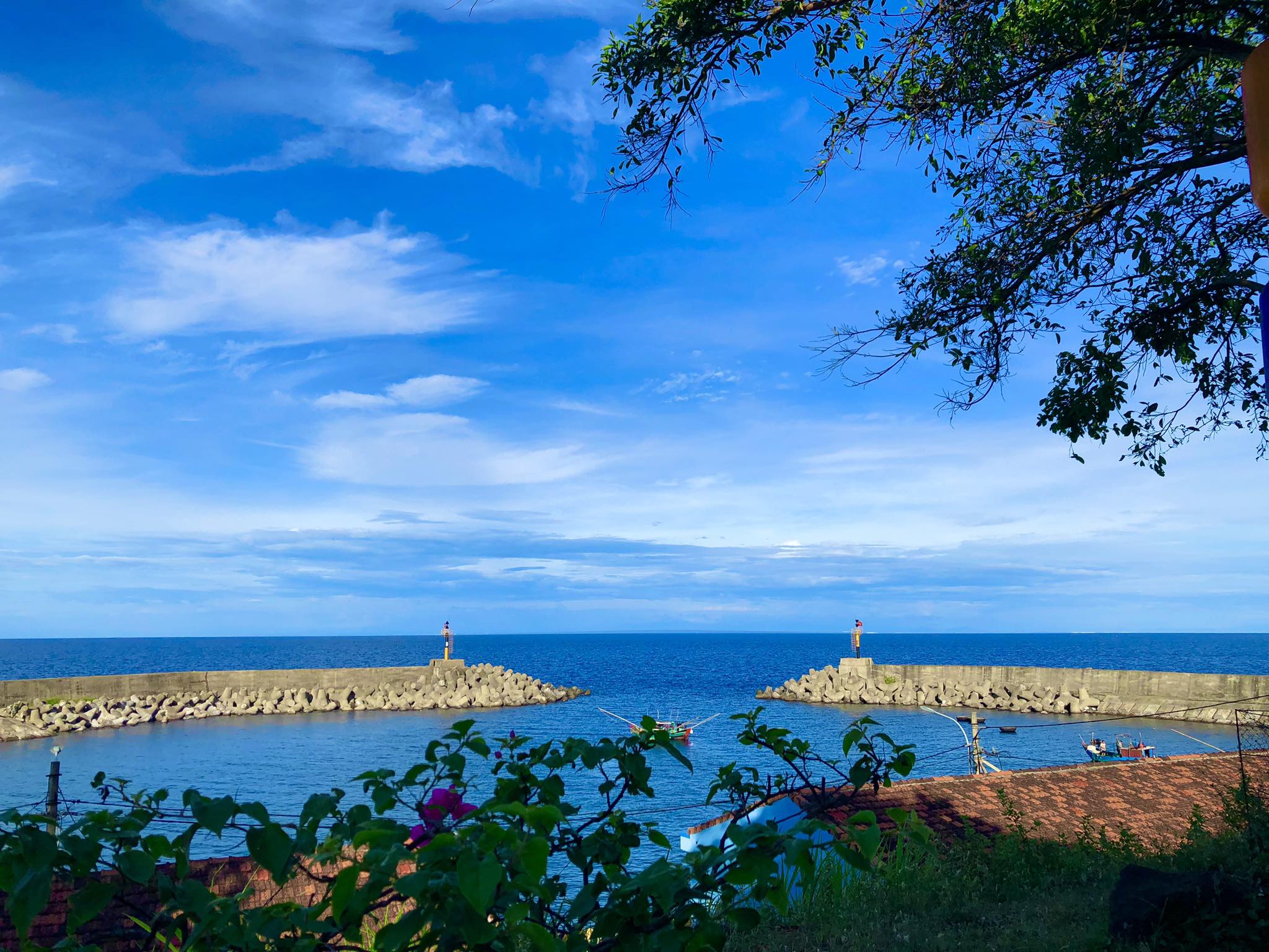
Lý Sơn Special Zone (Ly Son Island)
From July 1, 2025, Lý Sơn officially becomes a Special Zone. Located 15 nautical miles from Sa Kỳ Port, it consists of:
- Đảo Lớn (Cù Lao Ré)
- Đảo Bé (Cù Lao Bờ Bãi)
- Hòn Mù Cu
A volcanic island chain formed 11 million–3,000 years ago, Lý Sơn is known as a “living museum” of Vietnam’s sovereignty over the Hoàng Sa–Trường Sa archipelago.
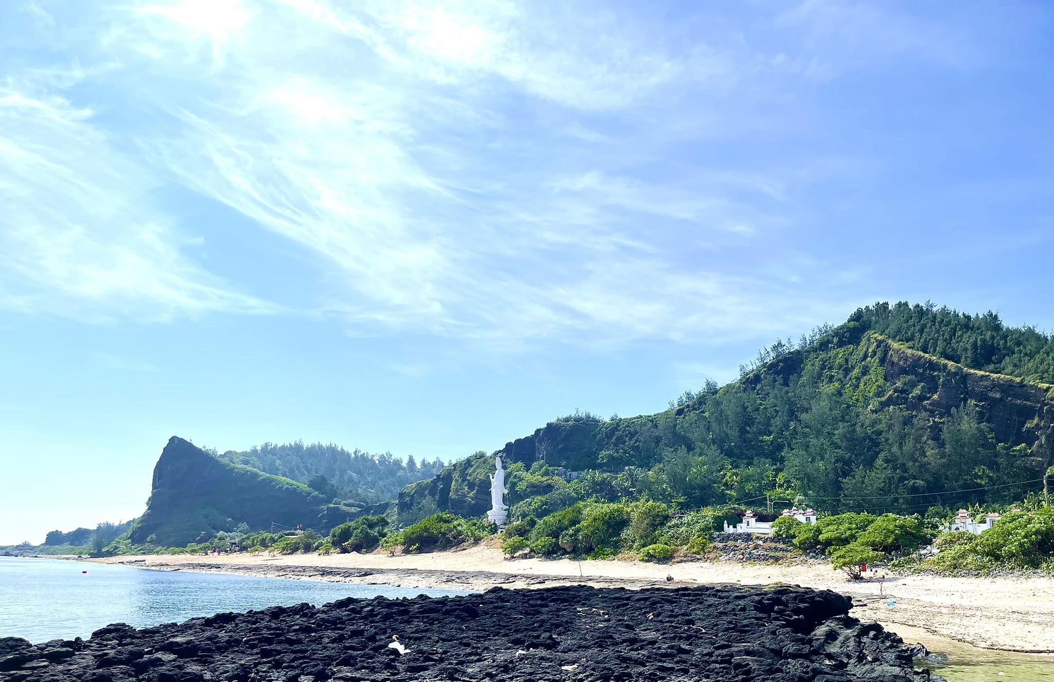
Đảo Lớn contains five volcanic craters (Thới Lới, Giếng Tiền, Hòn Sỏi, Hòn Tai, Hòn Vung), while Đảo Bé features two rare volcanic structures (Hòn Đụn, Bãi Hang).
With over 24,000 residents and the highest population density among the 13 special zones, Lý Sơn thrives on fishing, garlic–onion farming, and tourism.
It is the homeland of the historic Hoàng Sa Flotilla, with preserved relics such as Âm Linh Tự, the Hoàng Sa Soldier Cemetery, and the Khao Lề Ceremony—symbols of Vietnam’s maritime sovereignty.
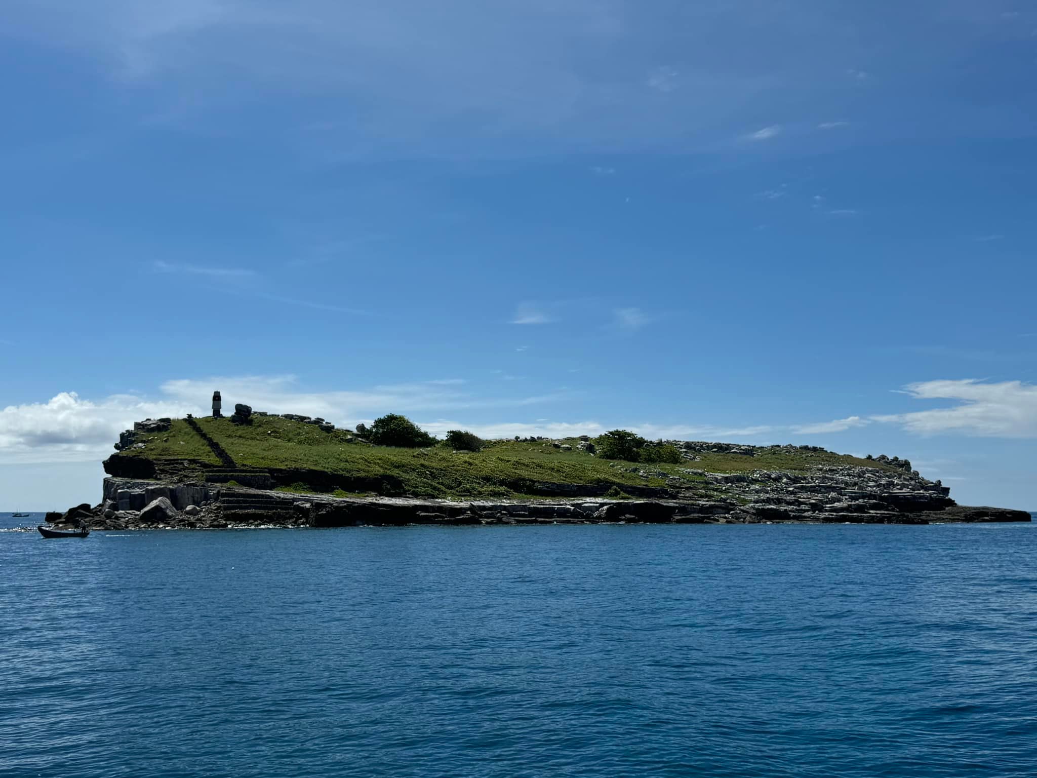
Hoàng Sa Special Zone
The Hoàng Sa (Paracel) Archipelago consists of 37 islands, reefs, shoals and maritime features, covering a maritime area of 30,000 km², with only 10 km² of land.
Key facts:
- Largest island: Phú Lâm (1.5 km²)
- Distance: 135 nmi from Ba Làng An; 123 nmi from Lý Sơn
- Climate: tropical, humid, frequent storms (June–August)
- Ecology: seabird colonies, sea turtles, limited freshwater sources
Hoàng Sa’s location along critical international shipping routes gives it immense strategic value in maritime and aviation security and resource potential.
Trường Sa Special Zone
With over 500 km², the Trường Sa (Spratly) Special Zone includes Trường Sa Town, Song Tử Tây and Sinh Tồn.
The archipelago comprises 100+ islands, reefs and banks, located: 248 nmi from Cam Ranh, 305 nmi from Vũng Tàu

Trường Sa has some of Vietnam’s most advanced island facilities:
- Harbors & large storm shelters
- Lighthouses (9 in total)
- Meteorological stations
- Schools & clinics
- Cultural sites (Trường Sa Pagoda, Song Tử Tây Pagoda, Nam Yết…).
- Nearly 100 households reside here, forming thriving island communities.
Phú Quý Special Zone (Phu Quy Island)
Located over 100 km offshore, Phú Quý now belongs to the newly formed Lâm Đồng province after a merger of Lâm Đồng – Bình Thuận – Đắk Nông.
It includes 12 islands with a total area of 17.82 km² and is a major fishing hub with 1,700+ fishing vessels and annual output exceeding 36,000 tons.

Electricity, clean water, education, and telecommunications are fully available. Poverty has dropped dramatically from 58 households (2005) to just 21 households (0.31%) by 2025.
With over 400,000 tourists in 2024, Phú Quý is rising as a top marine tourism destination, home to scenic spots like Bãi Nhỏ – Gành Hang, Triều Dương Bay, Cao Cát Mountain and Phú Quý Lighthouse.
Côn Đảo Special Zone (Con Dao Island)
Côn Đảo became the only special zone under Ho Chi Minh City on July 1, 2025. It lies 230 km southeast of the city, comprising 16 islands with 76 km² of land and 200 km² of sea area.
Côn Đảo is a sacred historical site with: Côn Đảo Prison, French–American Tiger Cages, Hàng Dương Cemetery…
It is also a biodiversity hotspot with coral reefs, mangroves, dolphins and Vietnam’s largest sea turtle nesting population.
Transport infrastructure—including airports, high-speed ferries, and upgraded ports—brings Côn Đảo closer to the mainland.
Kiên Hải Special Zone
Formed from Hòn Tre, Lại Sơn, An Sơn and Nam Du, Kiên Hải spans 27.85 km² across 23 islands, home to about 20,550 residents.
Key islands:
- Hòn Tre (4 km²)
- Lại Sơn (11.7 km²) – largest, popular for beaches
- An Sơn (6.75 km²) – center at Hòn Củ Tron
- Nam Du (4.4 km²) – pristine beaches, fishing villages
The special zone has abundant potential in fisheries, marine services and eco-tourism.
Phú Quốc Special Zone
Covering 589 km², the Phú Quốc Special Zone includes Dương Đông, An Thới and six surrounding communes.
Its strategic orientation focuses on: High-end tourism, Maritime logistics, Aquaculture & seafood processing, Renewable energy, High-tech industries
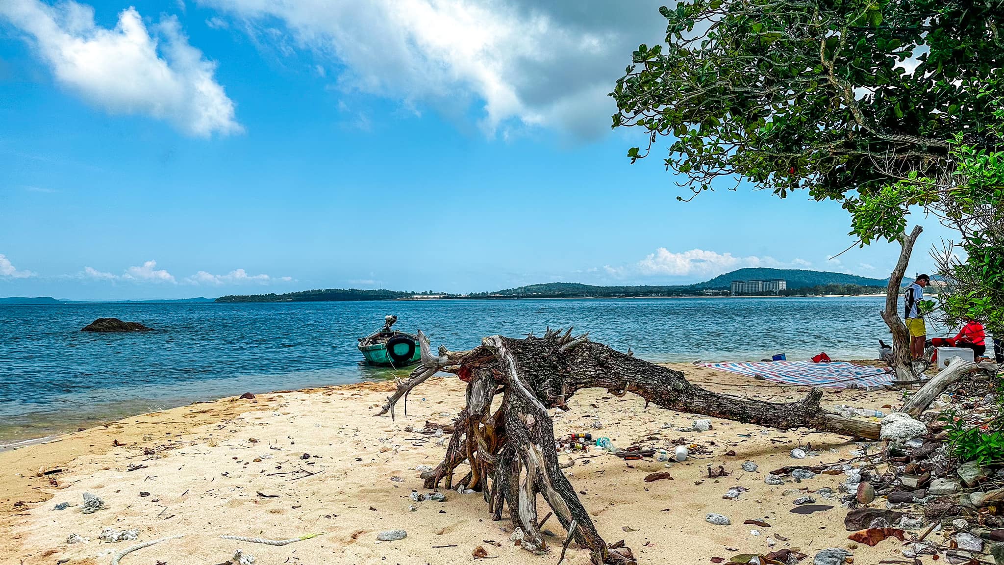
Phú Quốc maintains strong ecological commitments with a 26,000 ha Marine Protected Area, home to dugongs, coral reefs and endangered species.
Thổ Châu Special Zone
Part of An Giang province, Thổ Châu includes 8 islands with 13.98 km² of land and nearly 1,900 residents.
Located 101 km southwest of Phú Quốc and over 200 km from Rạch Giá, it holds critical national defense significance as a baseline point for defining Vietnam’s territorial waters.
Despite limited infrastructure and only one boat trip every five days, Thổ Châu possesses immense potential for future high-end eco-tourism.

)