

Guided Tour: Con Dao Town – Shark Cape – Ben Dam Port – Hon Ba – Love Peak
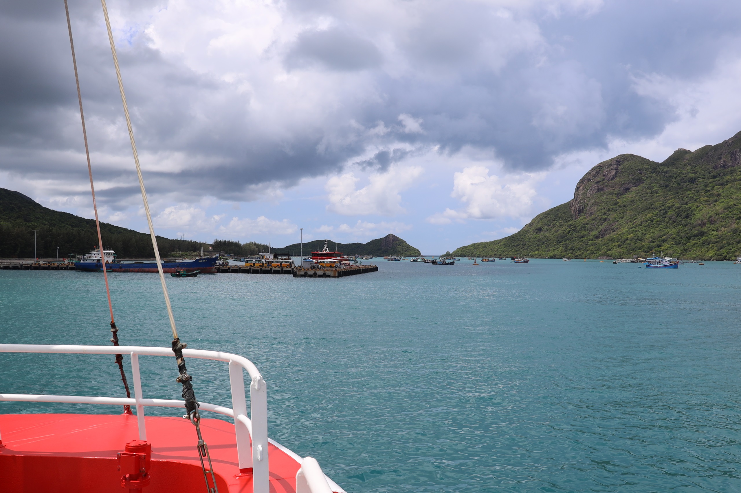
Ben Dam Port – The Gateway of Con Dao
To balance the landscape at both ends of the island, nature created a flat valley in the northeast—now home to Co Ong Airport—and a wide, sheltered bay in the south, where Ben Dam Port was formed. These two locations became the most important transportation hubs of Con Dao.
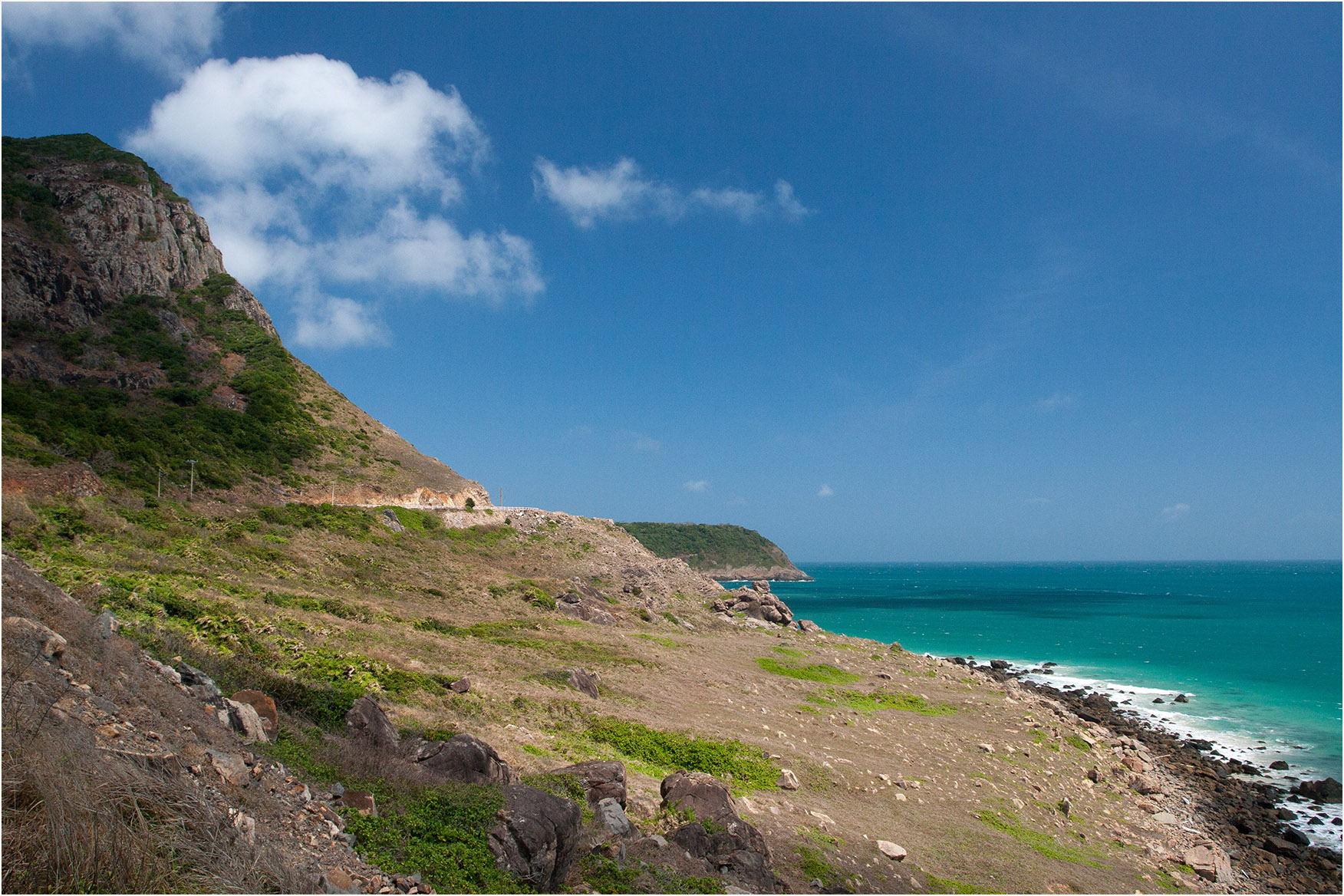
The name “Ben Dam” dates back to the French colonial era: Ben means a docking place; Dam refers to a calm lagoon. Traveling the 13 km coastal road from the town center to Ben Dam, visitors will enjoy a scenic route bordered by the vast blue sea on one side and towering cliffs on the other, passing beautiful spots such as Bai Da Trang, Shark Cape, and Love Peak.
Shark Cape – A Challenging Point of “Monsoon Winds”
Shark Cape earned its name because, on the map, the coastline here resembles the nose of a shark. Local lore says that in the past, political prisoners who refused to yield might be thrown into these shark-infested waters.
In reality, this is one of the most dangerous sections of the coastal road. One side drops sharply into the deep sea, while steep rock walls rise on the other. During the northeast monsoon (the “Chuong Wind”), strong gusts batter the cliffside, making passage extremely difficult. Harsh conditions over centuries have shaped a dense layer of low shrubs—plants with deep, interlocking roots that protect the island from erosion.
From this viewpoint, travelers can see Hon Tai Lon—one of Con Dao’s main sea turtle nesting beaches—along with Hon Trac Lon and Hon Trac Nho protecting the southern entrance of Con Son Bay. On clear days, this is also a magnificent sunrise spot.
Bai Nhat – Site of the 1952 Prison Break
Beyond its beauty, Bai Nhat is tied to a remarkable escape attempt during the 1952 monsoon season. Nearly 200 prisoners assigned to work at Ben Dam secretly dug tunnels beneath their barracks to build wooden boats. On December 12, 1952, five boats were launched from Bai Nhat. Due to bad weather and exposure, 117 escapees were captured, and 8 tragically perished at sea.
Today, a memorial stele at Bai Nhat honors that heroic event.
From Bai Nhat, looking westward, visitors can see Love Peak, formed by two adjacent mountain tops at an elevation of 328 m. Legend tells of a young couple forbidden to be together, who fled to Ben Dam and embraced each other until they turned to stone. This poetic scene inspired a well-known poem by Mr. Tran Dinh Hue, Deputy Director of Con Dao National Park.

Hon Ba – Island of the Legend of Lady Phi Yen
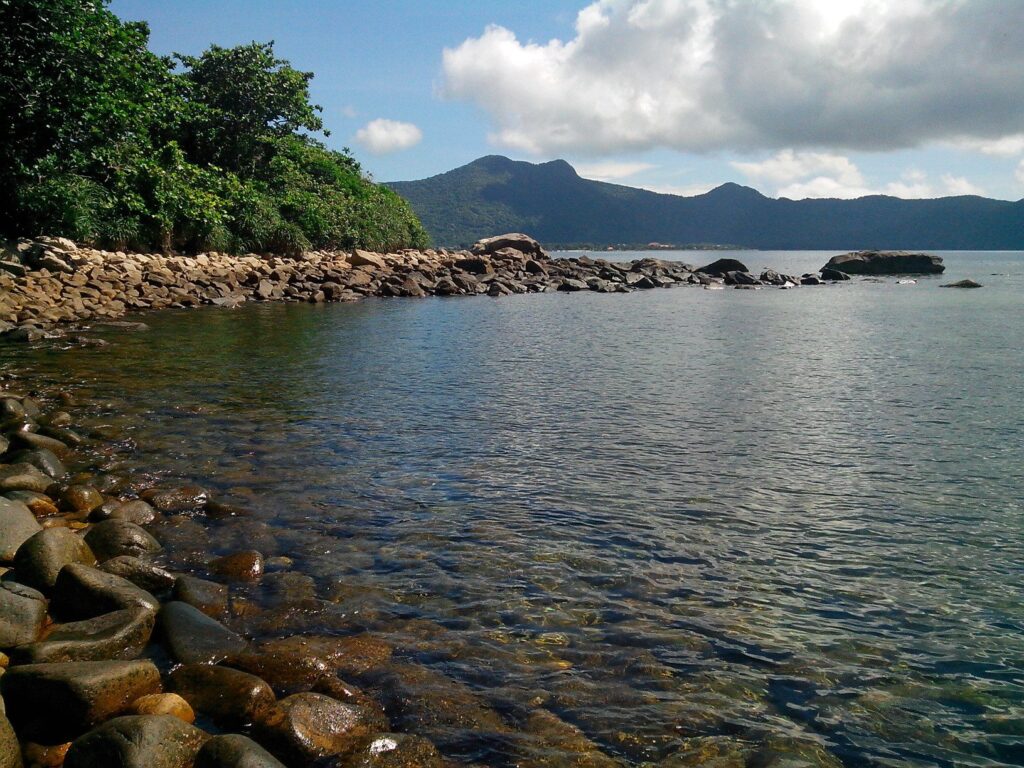
Hon Ba (also called Little Con Lon Island) covers about 576 hectares and is separated from the main island by a narrow 20-meter-wide waterway known as Cua Tu (“Death Gate”). The sheltered lagoon between the two islands is an ideal storm refuge.
According to legend, between 1783 and 1785, Nguyen Anh fled to Con Dao to escape the Tay Son army. When he planned to send Prince Cai to France as a political pledge, Lady Phi Yen strongly objected. Accused of colluding with Tay Son, she was imprisoned in a cave on this island—hence the name Hon Ba.
Exploring Dam Quoc – A Rare, Pristine Mangrove Ecosystem
From the Hon Ba Ranger Station, visitors trek about 2 km through a tropical rainforest featuring:
- hardwood species such as Găng Néo, Bằng Lăng, and giant banyans
- endemic wildlife: Con Dao black squirrel, long-tailed macaques, Nicobar pigeons, and white-breasted gular birds
Dam Quoc contains 5 hectares of mangroves—a rare, nearly untouched ecosystem that grows uniquely on sand, gravel, and dead coral substrate, unlike any other mangrove forest in Vietnam. More than 46 plant species thrive here, including Duoc Doi, Vet Du, Da Voi, with root systems spreading up to 6–8 meters.
Remarkably, Dam Quoc is home to the largest Red Mangrove (Coc Do) tree in Vietnam, as well as two newly recorded species: Avicennia hainesii and Xylocarpus rumphii.


