

Rising boldly amid the open sea, Hon Khoai appears like a steadfast frontier outpost guarding the skies, waters, and the southwestern edge of Vietnam. Its beauty is a harmonious blend of pristine nature, diverse ecosystems, heroic historical imprints, and monumental infrastructure projects now shaping a new future for the island. All these elements intertwine to create a Hon Khoai that is mysterious, poetic, and filled with the nation’s aspirations.
A Strategic Location – The Southern Sentinel of Vietnam
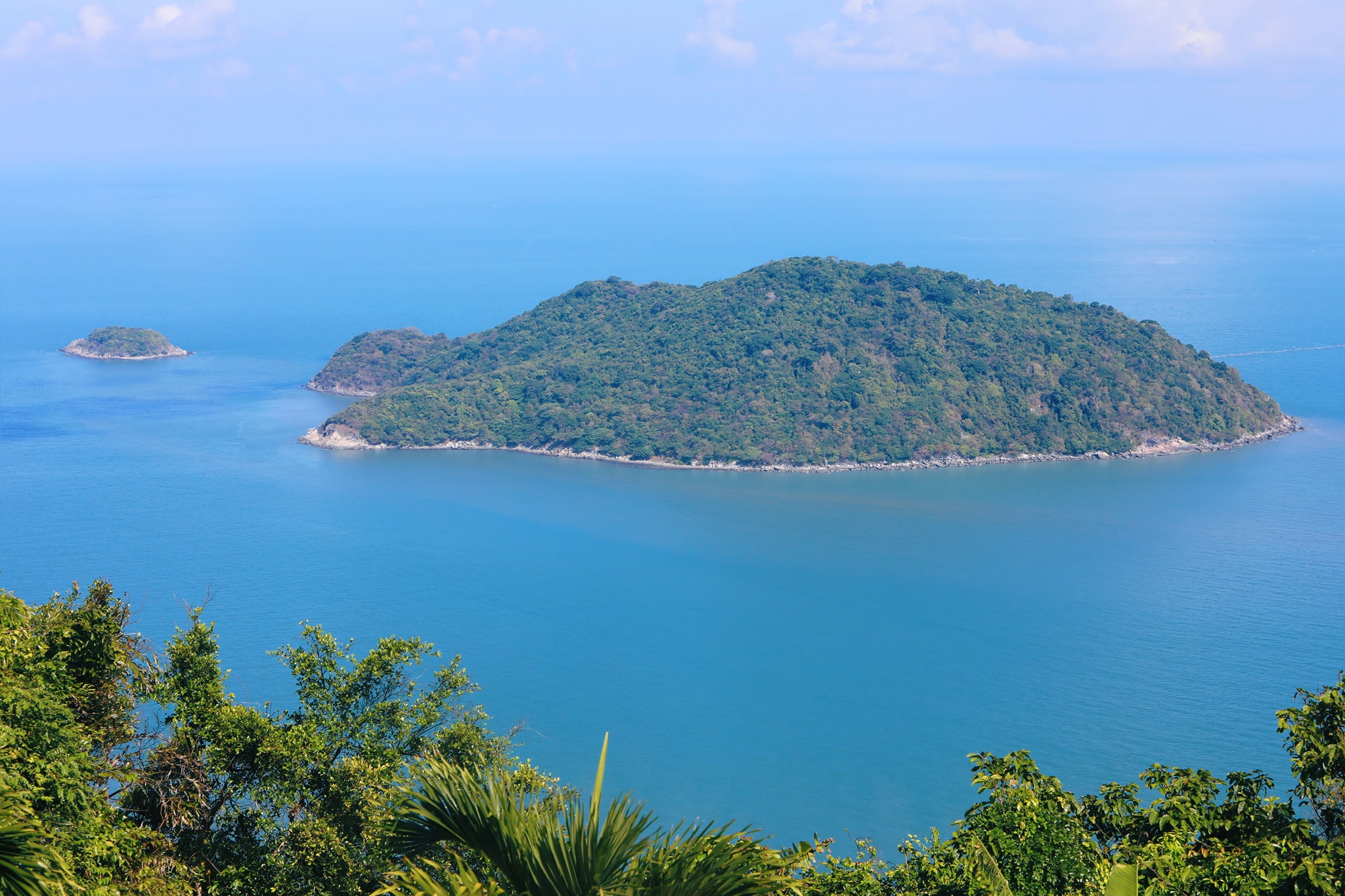
The Hon Khoai archipelago lies southeast of Cape Ca Mau, about 15 km off the mainland. Surrounding the main island are smaller islets such as Hon Sao, Hon Go, Hon Doi Moi, and Hon Da Le, forming a natural shield across the southwestern sea.
Among them, Hon Da Le (coordinates 08°22’08″N – 104°52’04″E) is officially recognized as Point A2 on Vietnam’s baseline, a legally significant point in defining the nation’s maritime sovereignty.
Hon Khoai Island, the largest in the archipelago, covers roughly 400 hectares, with rugged terrain and a peak rising 318 meters above sea level—a striking natural fortress overlooking the vast ocean.
Unlike many coastal islands, Hon Khoai possesses:
- Abundant natural freshwater sources
- Rich forest–marine ecosystems
- A 14 km coastal road around the island
- A surrounding sea area exceeding 1,200 km²
- Proximity to major international shipping routes
For generations, during calm seas, local residents from Ca Mau often traveled to Hon Khoai to collect freshwater for daily use—proof of the island’s remarkably generous natural resources.
Historical Significance – The Legendary Hon Khoai Uprising
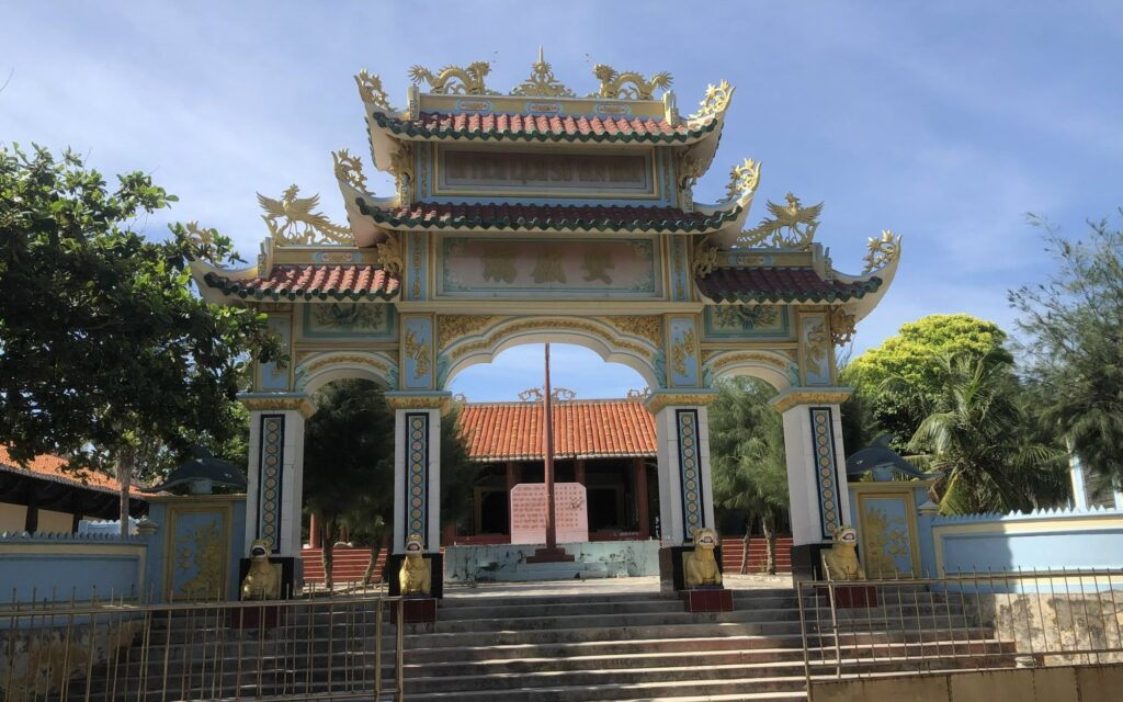
Hon Khoai is forever tied to the historic Hon Khoai Uprising, led by teacher and revolutionary fighter Phan Ngoc Hien on December 13, 1940, against French colonial rule.
This victorious uprising became a milestone of revolutionary history, and December 13 is commemorated annually as the Traditional Day of the Party, Armed Forces, and People of Ca Mau Province.
On April 27, 1990, Hon Khoai was officially recognized as a National Historical and Cultural Relic by the Ministry of Culture.
Despite its historical and geopolitical value, Hon Khoai remained largely undeveloped for decades, serving mainly defense and security purposes. As a result, no tourism or commercial routes were established, and images of the island rarely appeared online despite its well-known status.
Where Is Hon Khoai Island? – The Heart of Vietnam’s Southwestern Sea
Hon Khoai sits 14.6 km southeast of Cape Ca Mau, within Tan An Commune, Ngoc Hien District. Its 318-meter summit creates a dramatic silhouette in the middle of the sea.
The island has carried several names throughout history:
- Giang Tien Island
- Independence Island
- Poulop (French colonial name)
Local people call it Hon Khoai (“Potato Island”) because of its giant potato-like shape. In earlier times, settlers planted cassava and yam on the island, and remnants of these plants can still occasionally be found today.
The surrounding satellite islets—Hon Lon, Hon Nho, Hon Tuong, Hon Sao, Hon Doi Moi—form a diverse ecological cluster with great tourism potential.
Nature of Hon Khoai – Untouched, Vibrant, and Wild
Two Stunning Beaches: Bai Lon & Bai Nho
Hon Khoai features two beautiful sandy beaches:
- Bai Lon (southeast): wide, gentle shore, turquoise water
- Bai Nho (north): quiet, sheltered, ideal for anchorage
At low tide, visitors can walk along the exposed sandy stretches to explore marine life and enjoy the fresh sea breeze.
Primary Forest – A Rare Ecological Treasure
Hon Khoai is home to a tropical island rainforest boasting:
- Over 1,400 plant species
- Valuable timber trees: lim, bang lang, dầu rái, tram trắng
- Medicinal plants: huyet rong, cot toai bo, yam species, thien nien kien…
Its wildlife is equally diverse:
- Wild boars, monitor lizards, pythons, various snakes
- Black squirrels and troops of monkeys
- Seasonal blossoms: golden apricot flowers, purple bang lang, red coral flowers
This creates a vibrant, colorful natural scene rarely found on offshore islands.
Year-Round Freshwater – A Unique Advantage
The island contains several streams, including two perennial freshwater streams—a rare natural asset for coastal islands. These streams historically supplied water to fishing fleets operating near Rach Goc and Tan An.
A Rich Marine Ecosystem
The surrounding sea is a thriving habitat for:
- Lobster, mantis shrimp, squid
- Grouper, cobia
- Diverse coral and plankton communities
Its sheltered coastline makes Hon Khoai an essential storm refuge for fishermen.
Exploring Hon Khoai – The Forest Trail & 100-Year-Old Lighthouse
The 3 km Forest Road
Built by the French in the early 20th century, the 3 km road from Bai Lon to the summit cuts through lush rainforest. Walking this trail feels like stepping into a timeless natural world filled with wildlife sounds and deep green canopies.
Hon Khoai Lighthouse – A Century-Old Maritime Beacon
- Built: 1920
- Height: 12.5 m
- Each side: 4 m
- Range: 35 km
- Structure: stone and mortar, exceptionally durable
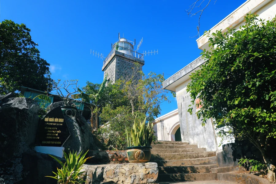
One of Vietnam’s earliest lighthouses, it stands as a striking testament to maritime history and offers spectacular panoramic views of the sea.
Hon Khoai Today – A New Era with Strategic Mega-Projects
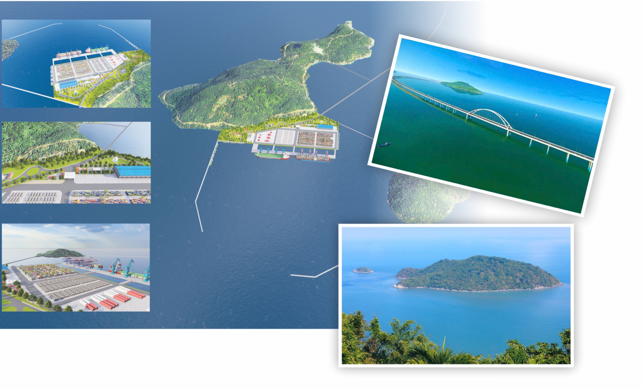
Hon Khoai Dual-Use Deep-Sea Port
Groundbreaking: August 19, 2025
Phase 1 capacity: 20 million tons/year
1,000 m main berth
Accommodates vessels up to 250,000 DWT
Expansion to 686 hectares
Additional general cargo and liquid–gas berths planned
This port is expected to become a major gateway for exports and imports of the Mekong Delta, easing pressure on ports in Ho Chi Minh City and the Southeast region.
Hon Khoai Sea-Crossing Bridge – A Symbol of Vietnam’s Aspirations
- Length: 18 km
- Design: 4 lanes, up to 80 km/h
- Investment: VND 25,700 billion
- Expected completion: 2028
Once finished, it will be Vietnam’s longest sea-crossing bridge and the third longest in Southeast Asia.
The bridge will drastically shorten travel time, turning Hon Khoai into a strategic hub for tourism, logistics, national defense, and regional development.
The Future of Hon Khoai – The “New Pearl Island” of the Southwest Sea
With:
- Lush primary forests
- Freshwater streams
- Untouched beaches
- National historical relics
- Deep-sea port and sea-crossing bridge
Hon Khoai is poised to become one of Vietnam’s most promising destinations for eco-tourism, historical exploration, and marine experiences.
When ongoing infrastructure projects are completed, the island will be more accessible than ever—ushering in a new chapter as the “pearl island” of the Southwest Sea.
More than 80 years after the Hon Khoai Uprising, this island—once a revolutionary symbol—now stands at the threshold of transformation. Hon Khoai is not only a natural wonder but also a cornerstone of Vietnam’s maritime sovereignty, national defense, and future economic growth.
Visitors to Hon Khoai will encounter not just untouched nature, but also a powerful historical spirit—where every wave and mountain ridge echoes the pride and resilience of the Vietnamese people.

