

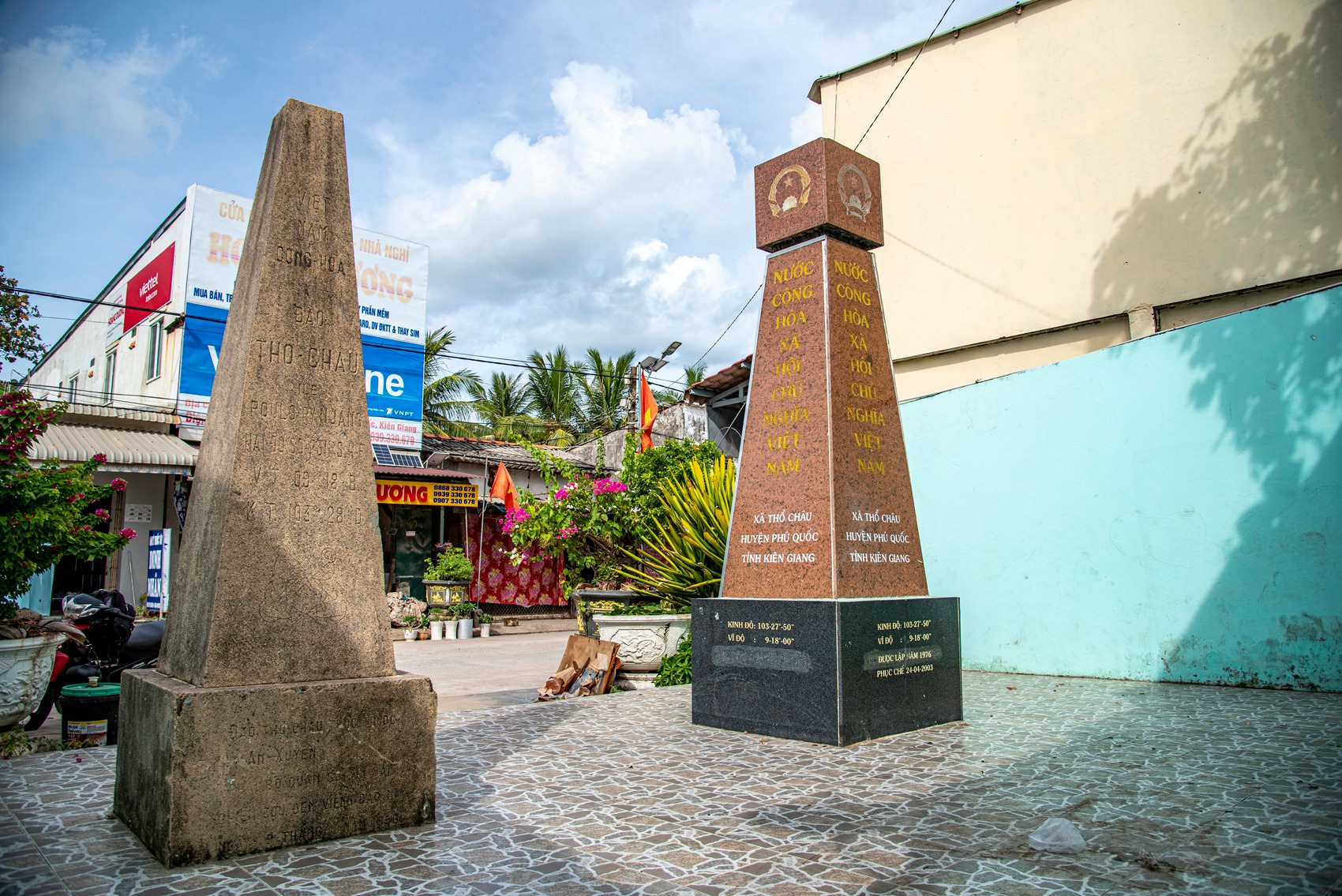
On Tho Chau Island, two maritime sovereignty markers built in 1956 and 1976 are still preserved today. Standing close to each other, these markers hold significant historical value. Notably, the 1956 marker still bears visible damage at its top, resembling bullet marks, evoking memories of past conflicts and the historical scars of this frontline island region.
The first marker was erected in 1956 under the Saigon administration, constructed from cement and exposed aggregate. Inscribed on its surface is the name “Poulo Panjang,” the former name of Tho Chau Island, meaning “Long Islet.” Though weathered and covered with moss over time, this marker remains an important historical testament affirming sovereignty and administrative presence on Tho Chau Island.
Beside it stands the sovereignty marker built in 1976, after the reunification of the country. Larger in scale and more formal in appearance, this marker was restored in 2003 and has since become a clear symbol of Vietnam’s sacred maritime sovereignty.
Today, the two markers are not only of historical and legal significance but also a popular sightseeing and check-in spot for visitors to Tho Chau Island, where the past and present converge amid the vast seascape of Vietnam’s southwestern waters.
