Winding through the mountains of Lam Dong Province, Dai Ninh Pass is one of the region’s most distinctive mountain roads. Located along National Highway 28B, the pass connects the eastern and highland areas of the province, crossing rugged terrain, forested slopes, deep valleys, and a series of challenging bends.
The road is closely associated with the development of the Dai Ninh Hydropower Project and the transformation of the former Luong Son – Dai Ninh route into an important regional transport corridor.
For travelers who enjoy road trips and mountain scenery, Dai Ninh offers something different from the more famous passes around Da Lat. Its appeal lies not in elaborate viewpoints or roadside attractions, but in the journey itself.
Where Is Dai Ninh Pass?
Dai Ninh Pass is located along National Highway 28B in Lam Dong Province.
The eastern section of the route passes through the mountainous area around Phan Son Commune, before continuing toward the Lam Dong highlands. Under the current administrative structure, Phan Son Commune was formed from the former Phan Lam and Phan Son communes, while Luong Son Commune was established from the former Luong Son Township and Song Binh Commune.
National Highway 28B now forms an important transport link within Lam Dong Province, connecting the eastern part of the province with the highland region.
A Winding Road Through the Mountains
The defining feature of Dai Ninh Pass is its terrain.
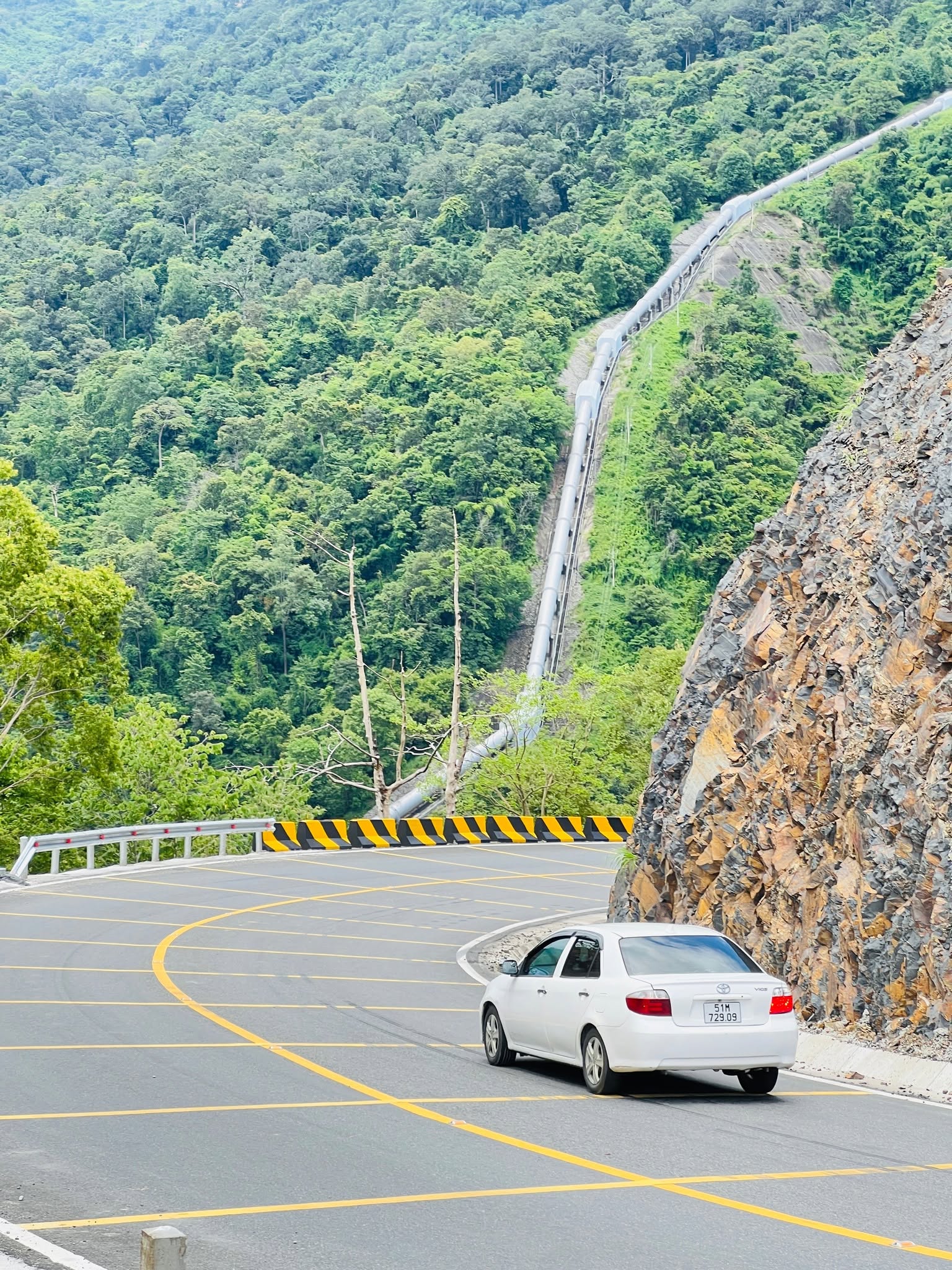
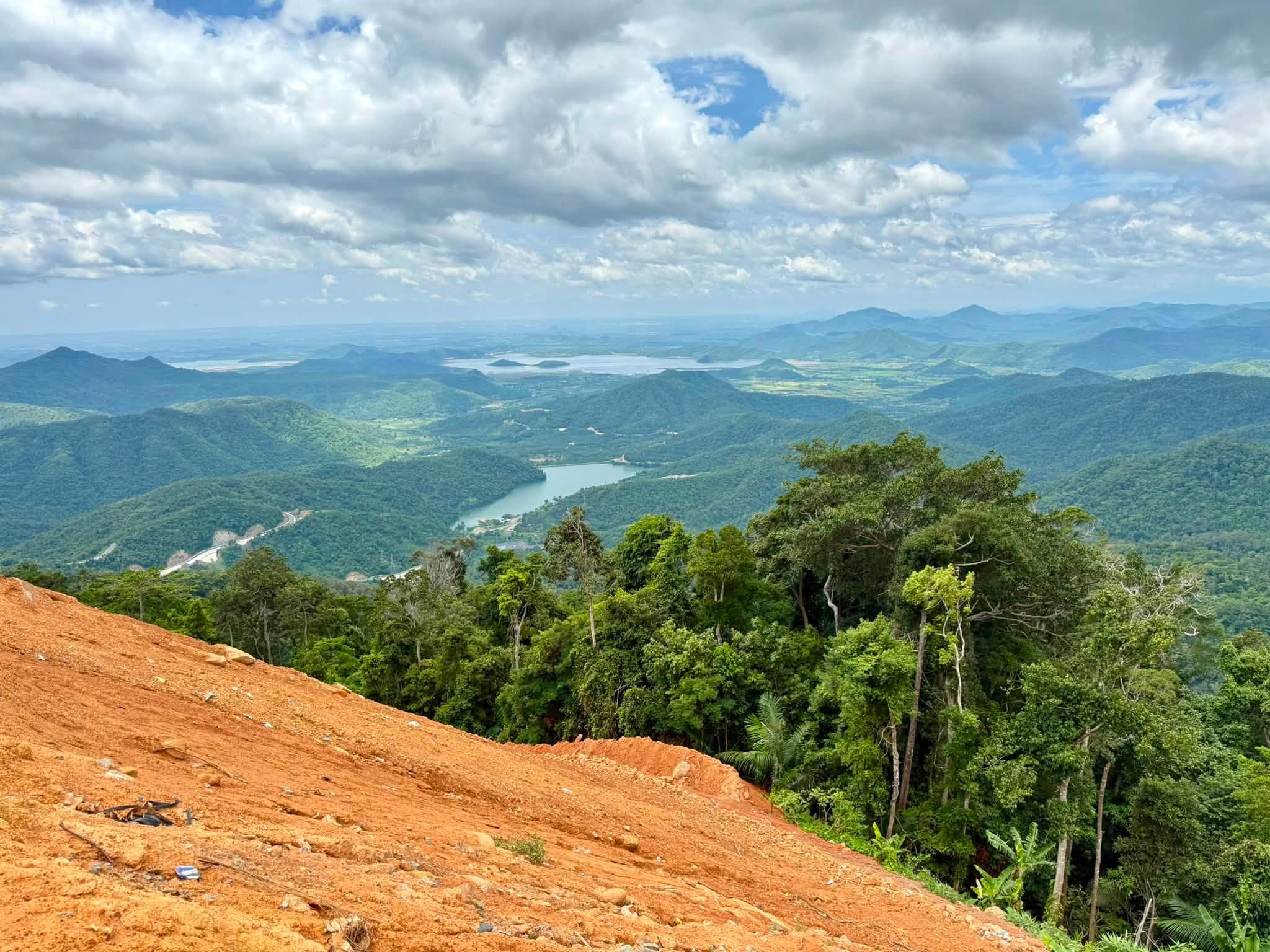
The road follows the mountainside through steep sections and successive bends. In some places, the road runs close to rocky slopes, while the opposite side opens toward deep valleys and layers of mountains.
As the elevation increases, the landscape changes noticeably. Lower hills gradually give way to greener forest, while clouds and mist can appear around the higher sections depending on weather conditions.
From several elevated points, travelers can catch distant views of Dai Ninh Lake, surrounding mountains, and broad valleys below.
Rather than offering a single spectacular viewpoint, Dai Ninh reveals its scenery gradually, with the landscape changing from one section of road to the next.
From a Hydropower Construction Road to National Highway 28B
The history of Dai Ninh Pass is closely connected with the construction of the Dai Ninh Hydropower Plant.
The original Luong Son – Dai Ninh route was developed to support construction activities, particularly the transportation of heavy equipment, materials, and supplies for the hydropower project.
After the project was completed, the road was repaired and upgraded for broader public use. In 2009, the government called for the repair of the Luong Son – Dai Ninh route and its transfer for local management and operation.
A road originally associated with a major construction project gradually became an important part of the regional transport network.
Dai Ninh Hydropower Project and the Surrounding Landscape
The Dai Ninh Hydropower Project is one of the defining landmarks of the area.
The hydropower plant has an installed capacity of 300 MW and forms part of the Dong Nai River system. In addition to power generation, the project has contributed to water regulation and supply for communities and agricultural areas in the eastern part of the province.
The reservoir and associated infrastructure have also created a distinctive landscape around Dai Ninh. From higher sections of the road, travelers can sometimes see the lake surrounded by forested mountains.
The combination of natural terrain and large-scale hydropower infrastructure gives the area a character that is quite different from the pine forests and urban landscapes of central Da Lat.
The Scenic Character of Dai Ninh Pass
Dai Ninh is not a mountain pass known primarily for flower gardens, architecture, or purpose-built photo spots. Its appeal comes from the landscape along the road itself.
The route constantly changes direction. At one point, the road hugs the mountainside; farther ahead, it opens toward a broad valley. Dense vegetation may cover both sides of the road, followed by stretches where the mountains become visible in the distance.
On cloudy mornings, layers of mist can settle over the hills, creating a dramatic highland atmosphere. After rainfall, the vegetation becomes particularly green, although road conditions may also become more difficult.
For travelers who enjoy photographing natural landscapes, the best views often come from simply finding a safe stopping point and taking time to look across the mountains.
National Highway 28B: A Major Upgrade
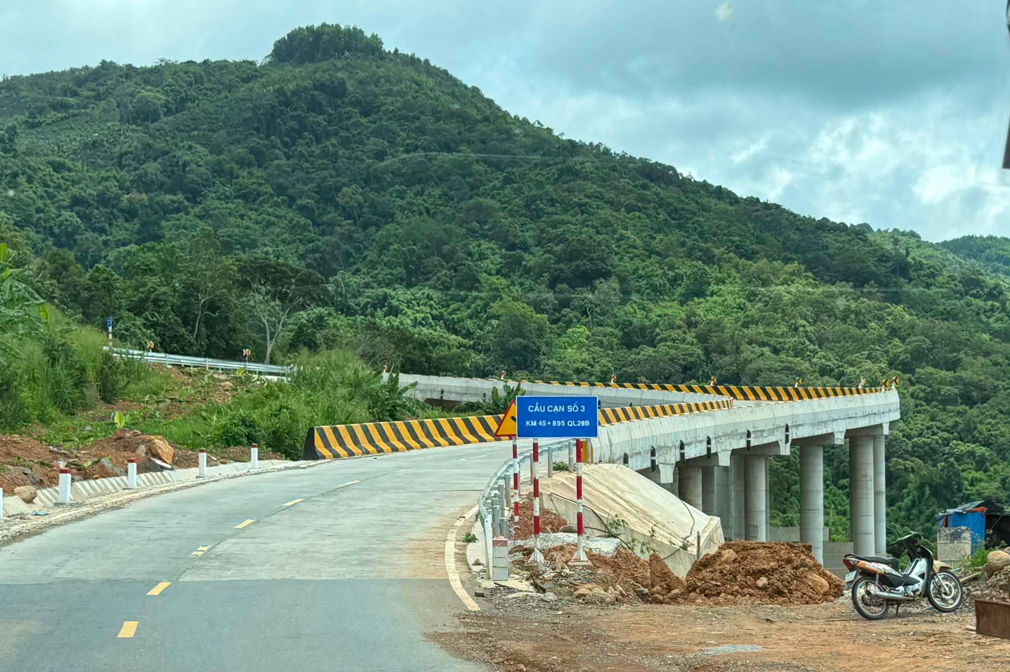
In recent years, National Highway 28B has undergone a major upgrading project designed to improve connectivity and road safety.
The project covers approximately 68 km, with an investment of more than VND 1.435 trillion. Construction began in April 2024.
By September 2026, approximately 67.1 km of the 68-km route had received asphalt surfacing, equivalent to about 98.68 percent of the project. All six bridges had also been completed, while remaining work included guardrails, road markings, drainage systems, slope protection, and emergency escape lanes.
The improvements are expected to strengthen transportation links within Lam Dong Province and make the route more practical for freight, local travel, and tourism.
The Economic and Transport Role of Dai Ninh
Dai Ninh is no longer simply a road associated with the hydropower project.
National Highway 28B provides an additional transport corridor connecting eastern Lam Dong with the highlands. The route supports the movement of agricultural products and other goods while providing local communities with an important regional connection.
For tourism, the road offers an alternative route between different landscapes within Lam Dong. Travelers can experience a noticeable transition from the warmer, drier mountain areas in the east toward the greener and cooler highlands farther west.
Riding Dai Ninh Pass by Motorbike
Dai Ninh is particularly appealing to travelers who enjoy motorbike trips and road journeys.
However, it is not a road to be approached at high speed. The best way to experience the route is to travel slowly, observe the changing scenery, and stop only at safe locations.
When approaching bends, reduce speed before entering the corner rather than braking sharply in the middle of it. On long descents, use an appropriate lower gear to take advantage of engine braking.
Avoid stopping on blind corners, near the edge of the road, or anywhere that could obstruct approaching vehicles.
Practical Driving Tips
Check Your Vehicle Before Leaving
Before starting the journey, check:
- Front and rear brakes
- Tires and tire pressure
- Headlights and brake lights
- Engine oil and coolant
- Fuel level
- Mirrors
For motorbikes, tire and brake condition are particularly important.
Use Lower Gears on Descents
Do not rely entirely on the brakes during long downhill sections. Selecting an appropriate lower gear provides engine braking and helps reduce heat buildup in the braking system.
Be Careful During Rain
Heavy rain can make the road slippery and increase the risk of falling rocks, mud, or landslides from mountain slopes.
Local authorities have also continued to monitor and address areas vulnerable to landslides, mud, and unstable slopes along National Highway 28B.
If heavy rain persists, check current road conditions before setting out.
Travel During Daylight
The combination of bends, steep terrain, and limited visibility in some sections makes nighttime travel more demanding.
Travelers unfamiliar with the route should ideally complete the mountain section during daylight.
Refuel Before the Mountain Section
Services are less frequent along remote mountain roads than in urban areas. It is therefore wise to fill the tank and prepare basic supplies before entering a long mountain section.
When Is the Best Time to Visit Dai Ninh Pass?
Weather plays a major role in the experience.
On dry, clear days, visibility is better, allowing travelers to see the surrounding mountains, valleys, and Dai Ninh Lake from higher sections of the road.
The rainy season brings greener vegetation and dramatic mountain scenery, but road conditions can change quickly. Heavy rainfall may increase the risk of landslides, falling rocks, and reduced visibility.
For sightseeing and photography, a day with stable weather and good visibility is generally the most comfortable choice.
Dai Ninh Pass and the Changing Landscape of Lam Dong
Following Vietnam’s administrative reorganization, the former Binh Thuan and Lam Dong provinces became part of the new Lam Dong Province.
This has created an especially interesting geographical setting for tourism. Coastal landscapes, eastern mountain areas, and the Central Highlands now lie within one provincial boundary.
Dai Ninh is one of the roads where this transition can be experienced most clearly.
During a single journey, the scenery can shift from sun-exposed hills and valleys in the east to greener mountain forests and cooler highland landscapes farther west.
A Mountain Road Worth Exploring
Dai Ninh Pass is not a destination where visitors arrive, take a few photographs, and immediately leave. Its attraction lies in the journey itself.
It is the rhythm of the bends, the mountains rising beside the road, the valleys opening below, the distant waters of Dai Ninh Lake, and the gradual change in landscape as the elevation increases.
Once associated primarily with the construction of the Dai Ninh Hydropower Project, the route has evolved into an important part of National Highway 28B and the transport network of Lam Dong Province.
For travelers who enjoy road trips, motorbike journeys, and mountain landscapes with a less commercial atmosphere, Dai Ninh Pass is a memorable route to explore in eastern Lam Dong.
Quick Facts
| Information | Details |
|---|---|
| Destination | Dai Ninh Pass |
| Road | National Highway 28B |
| Current province | Lam Dong Province |
| Main area | Phan Son Commune and the route toward the highlands |
| Associated with | Dai Ninh Lake and Dai Ninh Hydropower Plant |
| Highway upgrade | Approximately 68 km |
| Terrain | Mountain road with steep sections and successive bends |
| Scenery | Forests, valleys, mountains, Dai Ninh Lake |
| Best suited for | Road trips, motorbike journeys, scenic drives |
| Recommended conditions | Dry weather and good visibility |
| Safety | Check the vehicle, reduce speed, avoid stopping on blind corners, and watch for landslides during heavy rain |