


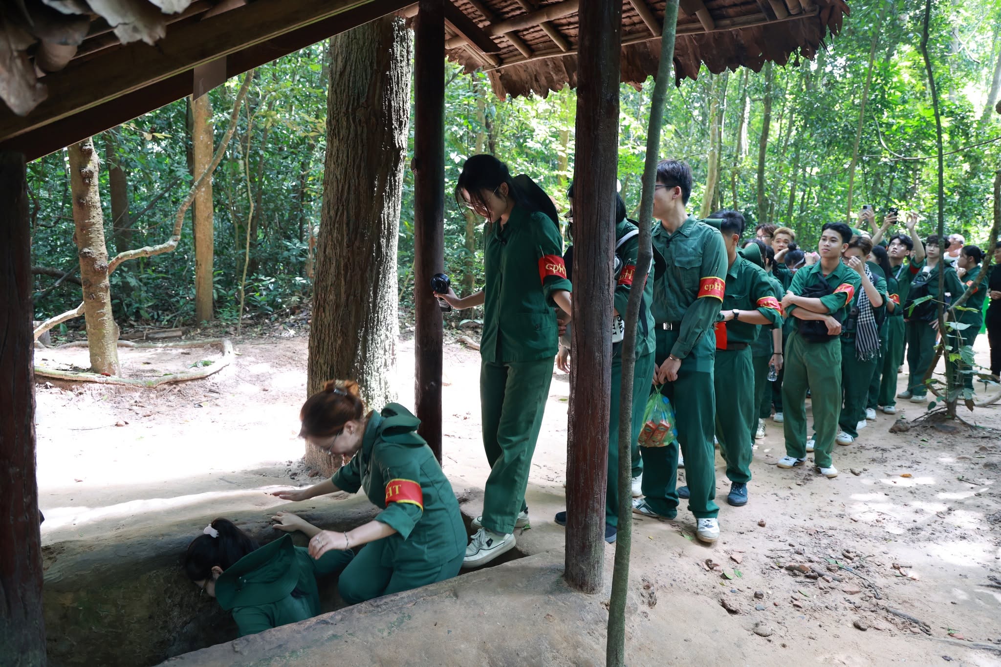
The Cu Chi Tunnels are an extensive underground military system developed during Vietnam’s two major resistance wars against French colonial rule and the United States. Located in an area historically known as the “Iron Land,” the tunnel network served not only as a shelter and a place to conceal documents, weapons, and personnel, but also as an interconnected battlefield associated with the activities of revolutionary leadership and command agencies, as well as the people and armed forces of Cu Chi.
The tunnels began to take shape around 1948, during the resistance against French colonial rule. The first sections were dug in Tan Phu Trung and Phuoc Vinh An communes, and the name Cu Chi Tunnels gradually came to refer to the underground system built throughout the area. At first, the tunnels consisted of short and relatively simple passages, mainly used to hide documents and weapons and provide shelter for revolutionary cadres operating behind enemy lines.
During the war against the United States, the system was progressively reinforced, expanded, and connected into a large underground network. From 1961, when the Regional Party Committee and the Command of the Saigon-Gia Dinh Military Region selected Cu Chi as an operational area, the tunnels increasingly served as a military, logistical, and command base. From 1966, as US military operations in southern Vietnam intensified, the people and armed forces of Cu Chi continued digging, expanding, and completing the underground system.
From the original short passages, the people of Cu Chi developed a multi-level and multi-branch tunnel network with a total length of more than 200 km, combined with approximately 500 km of trenches and above-ground fortifications. The tunnels were arranged as an interconnected defensive system, taking advantage of the natural terrain and linking combat positions with living quarters, logistical facilities, medical stations, and command posts. This created a distinctive battlefield that allowed revolutionary forces to remain in the area for long periods despite continuous military operations.
The Cu Chi Tunnels During the War
Throughout the existence of the base, US forces and the Saigon administration repeatedly launched operations aimed at destroying the tunnel system and revolutionary bases in Cu Chi. Methods included pumping water into the tunnels, sending specialized troops underground to search for and destroy tunnels, using trained dogs to detect entrances, employing heavy machinery to level the ground, and conducting large-scale military operations.
According to historical materials associated with the site, US forces and the Saigon administration carried out approximately 5,000 search-and-destroy operations in the Cu Chi base area. On average, around 330 operations were conducted each year, involving different forces, scales, and methods of warfare. Between 1954 and 1975, approximately 500,000 tons of bombs and ammunition were dropped on Cu Chi, equivalent to an average of about 1.5 tons of bombs and ammunition per resident. In addition, approximately 480 tons of chemical agents were used in the area.
Under these harsh wartime conditions, the tunnel network became a place where the people and armed forces of Cu Chi maintained their presence, organized combat operations, and sustained the activities of revolutionary agencies. From the tunnels, armed forces combined military, political, and military-proselytizing activities, employing tactics such as sniping, ambushes, raids, and close-range attacks. The use of terrain, fortifications, and underground networks helped revolutionary forces reduce the technological and logistical advantages of their opponents.
During the two resistance wars, the people and armed forces of Cu Chi participated in or organized 4,269 major and minor battles, putting 22,582 enemy troops out of action, capturing more than 10,000 US soldiers and 710 soldiers of the Saigon army, and persuading approximately 32,000 personnel to leave their units. Revolutionary forces destroyed or captured more than 5,168 military vehicles, most of them tanks and armored vehicles; shot down or damaged 256 aircraft, mainly helicopters; sank or destroyed 22 military boats and vessels; destroyed or damaged 173 bridges and culverts; captured 8,581 weapons of various types; and forced the withdrawal, surrender, or destruction of approximately 270 enemy outposts.
These figures reflect the scale of the fighting in Cu Chi and demonstrate the role of the tunnel system in maintaining forces and organizing a battlefield under continuous attack.
The war also caused enormous human and material losses. During the two resistance wars, 10,101 Cu Chi civilians were killed, while more than 10,000 soldiers and young people died. Approximately 28,421 houses were burned, and more than 20,000 hectares of fields, plantations, and forests were destroyed. These losses remain an important part of the historical memory preserved at the Cu Chi historical site.
Structure, Heritage Site and Historical Significance
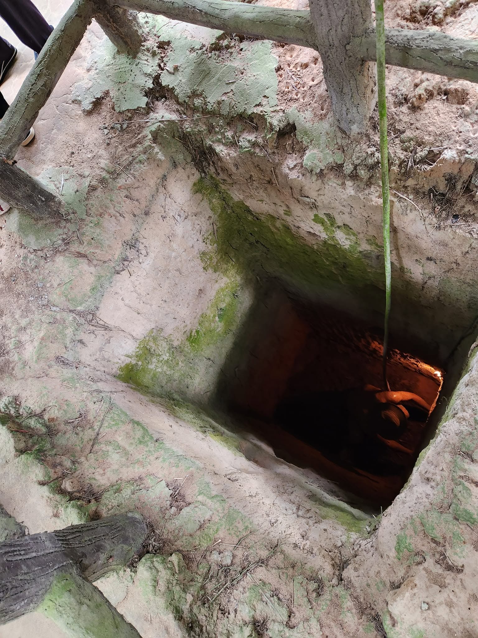
The Cu Chi tunnel system was organized around main underground passages that functioned as its backbone, from which numerous branches extended and connected with one another or operated independently according to the terrain. Some tunnel branches were dug toward the Saigon River, providing escape routes and connections with the Ben Cat base area in Binh Duong when necessary.
The tunnels were constructed at different depths and designed to withstand artillery pressure and the weight of tanks and armored vehicles. Some deeper sections were intended to reduce the impact of smaller bombs. Certain areas had two or three levels, known as the upper and lower levels. The different levels were connected by concealed entrances and exits fitted with secret covers.
Blocking points were installed at strategic locations to prevent enemy infiltration or restrict the spread of chemical agents through the tunnels. Some passages were extremely narrow, forming constricted sections that required people to bend or squeeze through.
Ventilation shafts were distributed along the tunnels and carefully camouflaged on the surface. Many entrances were combined with defensive positions and sniper posts. In vulnerable areas, the tunnel system was also connected with spike pits, nail pits, mines, and various types of traps. Defensive positions around some entrances included anti-tank mines and facilities designed to counter helicopter-borne forces.
The tunnels were not limited to military purposes. They developed into a relatively complete underground living environment. Connected to the tunnel routes were resting shelters where hammocks could be hung, storage areas for weapons and food, wells, Hoang Cam kitchens, offices for revolutionary leaders, military medical shelters, surgical rooms, and facilities for treating wounded personnel. Some reinforced A-shaped shelters were designed to protect women, elderly people, and children.
Larger underground spaces with roofs and camouflage structures were also used for meetings, daily activities, and cultural performances. In this way, the tunnels formed an integrated system serving combat, command, logistics, medical care, and everyday life during prolonged warfare.
Today, the Cu Chi Historical Site includes major areas such as the Ben Duoc Tunnels, which contain the Saigon-Gia Dinh Military Region Headquarters Area (Area A) and the Saigon-Gia Dinh Party Committee Headquarters Area (Area B), as well as the Ben Dinh Tunnels, associated with the Cu Chi District Party Committee.
The Area I protection zone includes sections of the tunnel network and reconstructed or restored facilities in Areas A and B and at Ben Dinh. The Saigon-Gia Dinh Military Region Headquarters Area (Area A) covers 66,586.4 m² and includes tunnels and numerous facilities for command, combat, daily life, and logistics, such as meeting halls, spike pits, command bunkers, working and resting shelters, A-shaped shelters, wells, combat positions, tunnel entrances, ventilation shafts, military medical facilities, surgical shelters, Hoang Cam kitchens, dining areas, uniform-making shelters, engineering workshops, displays of improvised weapons, bomb craters, medical stations, and visitor facilities.
A complex consisting of a ventilation mound and two tunnel entrances leading toward the Saigon River covers approximately 667.9 m², illustrating an important connection between the underground system and the surrounding terrain.
The Saigon-Cholon Regional Party Committee Headquarters Area (Area B) covers 16,664.8 m². It includes the tunnel system and facilities associated with the activities of revolutionary leadership, including Hoang Cam kitchens, medical shelters, food storage, document rooms, security shelters, living and working shelters for the Secretary of the Saigon-Gia Dinh Party Committee, meeting shelters for the Standing Committee, bomb craters, leadership shelters, a meeting hall, and a water shelter used for fire prevention and firefighting.
The Ben Dinh Tunnels cover 67,086.2 m² and include tunnels and reconstructed facilities illustrating the combat and daily activities of guerrilla forces and the Cu Chi District Party Committee. Facilities include a screening hall, secret shelters, spike pits, individual combat positions, trenches, tunnel entrances and exits, reconstructed guerrilla living spaces, camouflaged ventilation shafts designed as termite mounds, an M41 tank, an improvised weapons exhibition house, an engineering workshop, reconstructed traditional craft facilities for rice-paper making, rice wine production, and rice milling, a tunnel-digging reconstruction area, a military uniform workshop, a facility producing traditional rubber sandals, a B-52 bomb crater, security shelters, leadership living and working shelters, a meeting hall, Hoang Cam kitchen, dining shelter, smoke storage and exhaust facilities, and a medical shelter.
The Area II protection zone surrounds parts of Areas A and B and Ben Dinh and contains memorial, exhibition, and historical reconstruction facilities.
Among them is the Ben Duoc Martyrs Memorial Temple, covering approximately 40,299.3 m². Construction began on 19 May 1993, with the first phase inaugurated on 19 December 1995. The complex includes gardens, a ceremonial gate, a stele house, a temple, and a tower. Its basement contains exhibitions of sculptures, bronze works, paintings, scale models, and panels presenting major events of the resistance war against the United States involving the people and forces of Saigon, Cholon, and Gia Dinh. The exhibition, titled “Saigon-Gia Dinh Resilient and Indomitable,” is divided into nine thematic sections.
The Liberated Zone Reconstruction Area, East Sea Landscape and Architectural Simulation Area, and Cedar Falls Campaign Model Exhibition House cover a combined area of approximately 197,633.5 m².
The Liberated Zone Reconstruction Area presents the landscape of Cu Chi from the Dong Khoi movement in 1961 to 1974, including reconstructed facilities such as a village gate in a liberated area, a tunnel-digging scene, a communications station, residential houses, a bicycle repair shop, a barber shop, a youth education classroom, a school, exhibitions on the fighting at So Dat Thit and Nga Ba Cay Go, a workshop producing mines from unexploded bombs and artillery shells, reconstructed residential areas, damaged pagodas and temples, a meeting of the Saigon-Gia Dinh Party Committee, and a representation of the restricted “white zone.”
The East Sea landscape and architectural simulation area presents an image of Vietnam stretching along the East Sea. Three miniature structures represent architectural and cultural symbols of northern, central, and southern Vietnam: One Pillar Pagoda, Ngo Mon Gate in Hue, and Nha Rong Wharf. Construction began on 24 May 2008, and the structures were inaugurated on 19 December 2009.
Another major facility is the Temple of the Saigon-Cholon-Gia Dinh Revolutionary Tradition Area, covering approximately 41,582.7 m², with gardens, a three-entrance gate, a main temple, two auxiliary temples, and supporting facilities.
The historical site also contains a sports shooting range, administrative offices, hotel facilities, restaurants, parking areas, and other facilities supporting the operation and preservation of the site.
The Cu Chi Historical Site was a place where the leadership agencies of the Saigon-Gia Dinh Party Committee and Military Region lived, worked, and directly directed revolutionary activities in Saigon-Gia Dinh. Several cadres who worked here later became senior leaders of Vietnam, including Nguyen Van Linh, Vo Van Kiet, Tran Bach Dang, and Mai Chi Tho.
The tunnels were also closely associated with the lives, combat activities, and sacrifices of the people and armed forces of Cu Chi. From underground, revolutionary forces organized military, political, and logistical activities and maintained their presence in the base area despite continuous attacks.
The outstanding value of the Cu Chi Tunnels lies in the extensive underground system developed over many years and adapted to the terrain and conditions of warfare. The tunnels were closely integrated with trenches, fortifications, traps, combat shelters, and facilities supporting everyday life. Together, they represent an important example of military organization and the practice of people’s warfare in 20th-century Vietnamese history.
Today, the Cu Chi Historical Site is a destination for tourism, historical research, and education about revolutionary traditions. Its spaces introduce visitors to the lives and activities of the people and armed forces of Cu Chi while commemorating those who died during the two resistance wars. The site therefore contributes to preserving the historical memory of the Saigon-Cholon-Gia Dinh region.
For its outstanding historical, military, and revolutionary values, the Cu Chi Tunnels Historical Site, Cu Chi District, Ho Chi Minh City, was recognized by the Prime Minister as a Special National Monument under Decision No. 2367/QD-TTg dated 23 December 2015.


