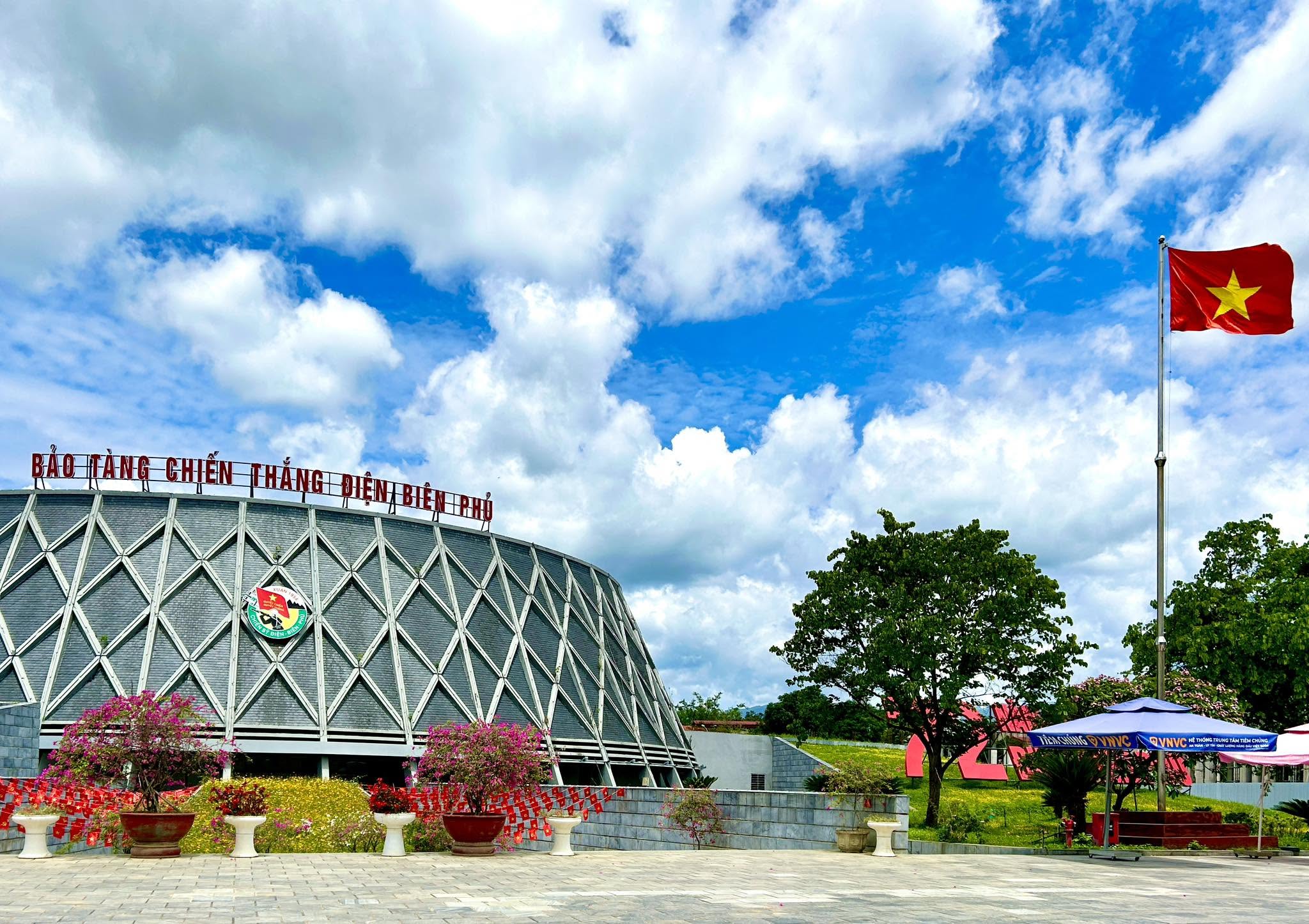
The Dien Bien Phu Battlefield Historical Site is a system of monuments commemorating important events of the 1954 Dien Bien Phu Campaign, while also serving as a prominent historical testament to the Vietnamese people’s victory in the prolonged resistance war against French colonial rule. The system of monuments vividly reflects the determination to fight and win, the spirit of national solidarity, and the strength of the entire Vietnamese nation in confronting a powerful military force equipped with modern weapons and warfare technology.
The victory at Dien Bien Phu on May 7, 1954 completely defeated the French colonial government’s Navarre Plan, creating a decisive turning point in the resistance war against French colonialism and compelling the French Government to sign the Geneva Accords on the cessation of hostilities in Indochina. The victory contributed to the complete liberation of northern Vietnam, ushering in a period of socialist revolution in the North. It also strongly encouraged national liberation movements around the world and accelerated the gradual collapse of large parts of the colonial system of imperialism.
With its exceptional historical, military, cultural and scientific values, the Dien Bien Phu Battlefield Historical Site was recognized by the Prime Minister of Vietnam as a Special National Heritage Site under Decision No. 1272/QD-TTg dated August 12, 2009. However, through continued research, documentation and inventory work, many locations that played significant roles during the Dien Bien Phu Campaign have continued to be identified and scientifically documented for inclusion in the heritage site system.
On December 23, 2015, the Prime Minister issued Decision No. 2367/QD-TTg recognizing an additional 23 sites as components of the Dien Bien Phu Battlefield Historical Site. These sites are distributed across Dien Bien Phu City, Dien Bien District and Tuan Giao District in Dien Bien Province, with a combined protected area of 545,505.75 square meters. Of this total, Protection Zone I covers 349,708.72 square meters and Protection Zone II covers 195,797.03 square meters.
The System of Sites within the Dien Bien Phu Strongpoint Complex
D Hill Historical Site
D Hill is located in Muong Thanh Ward and Tan Thanh Ward, Dien Bien Phu City, and consists of the D1, D2 and D3 heights. D1 had previously been recognized as a component monument of the Special National Heritage Site of the Dien Bien Phu Battlefield, while D2 and D3 were added during the 2015 recognition process.
D2 Hill has a Protection Zone I area of 8,279.85 square meters and no Protection Zone II. D3 Hill has a Protection Zone I area of 800 square meters and a Protection Zone II area of 7,600 square meters.
During the construction of the Dien Bien Phu Strongpoint Complex, the French colonial forces developed the D Hill area into an important military position that directly controlled the central sector and Muong Thanh airfield. It was one of the key positions protecting the central sector from the east.
At exactly 5:00 p.m. on March 30, 1954, Vietnamese artillery simultaneously opened fire on D Hill and the eastern heights overlooking the central Muong Thanh area, marking the beginning of the second offensive phase of the Dien Bien Phu Campaign. Supported by artillery, Vietnamese infantry units advanced to capture the French defensive positions one by one. The fighting was extremely fierce, with Vietnamese forces contesting every gun emplacement, trench section and meter of ground. After two days of fighting, the Vietnamese army completely controlled D1, D2 and D3, creating conditions for an expanded offensive toward the central sector of the Dien Bien Phu Strongpoint Complex.
105mm Artillery Position of the Dien Bien Phu Strongpoint Complex
The 105mm artillery position is located in Thanh Binh Ward, Dien Bien Phu City, with a Protection Zone I area of 334.4 square meters and no Protection Zone II.
From November 20 to 22, 1953, the French colonial forces deployed six airborne battalions, totaling approximately 4,500 troops, by parachute to occupy Dien Bien Phu. After taking control of the area, the French gradually transformed it into a powerful military strongpoint complex consisting of 49 strongpoints organized into eight clusters across three sectors: the Northern Sector, Central Sector and Southern Sector.
The 105mm artillery system was an important component of the strongpoint complex’s firepower network. Its missions included supporting defensive positions, controlling Vietnamese attack directions and protecting the Muong Thanh central sector. The inclusion of this artillery position in the heritage system helps clarify the scale of the French defensive organization, its firepower capabilities and the military structure of the Dien Bien Phu Strongpoint Complex.
Cháy Hill Historical Site
Cháy Hill is located in Muong Thanh Ward, Dien Bien Phu City, with a Protection Zone I area of 23,856.1 square meters and no Protection Zone II.
During the Dien Bien Phu Campaign, the 174th Regiment of the 316th Division used Cháy Hill as a mortar position and regimental command post. The site played an important role in organizing fire support, command and coordination with infantry units attacking the central sector of the strongpoint complex.
On the night of May 6, 1954, the 174th Regiment received orders to attack A1 Strongpoint. After capturing A1, part of the force remained to hold the position while the rest withdrew to Cháy Hill to reorganize, reinforce its ranks and prepare for subsequent battles. From Cháy Hill, mortar units and 75mm artillery continuously provided fire support for infantry advancing toward the center of the Dien Bien Phu Strongpoint Complex, making an important contribution to the final general assault.
F Hill Historical Site
F Hill is located in Muong Thanh Ward, Dien Bien Phu City, with a Protection Zone I area of 59,535.97 square meters and no Protection Zone II.
Together with A1 Hill, F Hill was one of the strategically important heights east of the central sector of Dien Bien Phu. It protected the flank of the eastern sector and worked in coordination with other heights to form a defensive line protecting the central area of the strongpoint complex.
For the Vietnamese army, capturing F Hill would provide an artillery and weapons position from which medium machine guns, heavy machine guns and recoilless rifles could directly threaten the A1, C1 and C2 strongpoints, while also controlling the flank and front of the French positions in the east. From this location, Vietnamese firepower could provide effective support for infantry attacks.
After fierce fighting, by the early morning of May 7, 1954, Vietnamese forces had completely taken control of F Hill. Control of the height contributed to breaking the eastern defensive system, creating conditions for Vietnamese forces to advance deeper into the central sector and carry out the final general assault that ended the campaign.
E2 Hill Historical Site
E2 Hill is located in Tan Thanh Ward and Him Lam Ward, Dien Bien Phu City, with a Protection Zone I area of 76,466.5 square meters and no Protection Zone II.
E2 Hill was selected as the forward command post of the 312th Division during the Dien Bien Phu Campaign. The position served command operations, battlefield observation and coordination among units during attacks on French strongpoints east and northeast of the central sector.
When Vietnamese forces launched their attack on E1 Strongpoint, the French deployed troops to E2 Hill to occupy and protect the position. However, under intense Vietnamese artillery and mortar fire, the enemy forces were unable to advance and were forced to withdraw to E1 Strongpoint. The event demonstrates the role of E2 Hill in establishing the command structure and providing fire support for attacking units.
Sites Associated with the People’s Army of Vietnam
Dien Bien Phu Campaign Observation Post at Muong Phang
The Dien Bien Phu Campaign Observation Post at Muong Phang is located in Muong Phang Commune, Dien Bien District, with a Protection Zone I area of 160 square meters and a Protection Zone II area of 5,230.5 square meters.
Chief of Staff Hoang Van Thai selected Mount Pu To Co as the location for the campaign headquarters’ observation post. The position was near the Dien Bien Phu Campaign Headquarters in the Muong Phang forest and offered a wide field of observation, allowing commanders to monitor different sectors of the battlefield and track French activities in the Dien Bien Phu valley.
The campaign headquarters at Muong Phang and the observation post on Pu To Co were kept under strict secrecy throughout their operation. From the time the command moved there until the campaign ended, the command system continuously and securely monitored the battlefield, transmitted orders and organized military operations.
Na Tau Km62 Frontline Logistics Station Historical Site
The Na Tau Km62 Frontline Logistics Station is located in Na Nhan Commune, Dien Bien District, with a Protection Zone I area of 380.5 square meters and a Protection Zone II area of 4,520.5 square meters.
The Na Tau frontline logistics station operated here for 13 days, from January 18 to January 30, 1954, during the same period that part of the Dien Bien Phu Campaign Command operated in the area. The station was responsible for receiving, storing and forwarding food, weapons, ammunition and essential supplies for the campaign.
The existence of the Na Tau logistics station demonstrates that the Vietnamese army’s logistical system operated across a vast area extending from the rear to the front line. It helped sustain the fighting capacity of troops under difficult conditions of mountainous terrain, poor transportation infrastructure and continuous enemy air attacks.
Pha Din Pass Historical Site
Pha Din Pass is located in Toa Tinh Commune, Tuan Giao District, with a Protection Zone I area of 137,083.4 square meters and a Protection Zone II area of 137,686.53 square meters.
Pha Din Pass is approximately 32 kilometers long. It begins in Toa Tinh Commune, Tuan Giao District, Dien Bien Province, and ends in Phong Lai Commune, Thuan Chau District, Son La Province. During the Dien Bien Phu Campaign, it was one of the vital transportation routes connecting the rear with the battlefield and played a particularly important role in transporting troops, weapons, ammunition, food and other supplies needed for the campaign.
Because of its strategic position, forces and equipment moving toward Dien Bien Phu from the rear had to cross Pha Din Pass. Recognizing the importance of this route, the French repeatedly used reconnaissance aircraft and bombers to disrupt transportation. Enemy aircraft could appear dozens of times a day, dropping various types of bombs, including high-explosive bombs, delayed-action bombs, fragmentation bombs and napalm bombs. Pha Din Pass consequently became known as a vast “bomb pocket.” On some days, as many as 160 bombs were dropped here, with the pass facing an average of approximately 16 tons of bombs and ammunition per day.
Under extremely difficult and dangerous conditions, more than 8,000 young volunteer workers remained at the pass, building roads, filling bomb craters, repairing bridges and roads, and maintaining uninterrupted transportation so that troops, weapons and food could reach the front in time. The sacrifices of the young volunteers at Pha Din Pass became a powerful symbol of endurance, courage and the quiet contribution of the rear to the victory of the Dien Bien Phu Campaign.
Hand-Pulled Artillery Road Historical Site
The Hand-Pulled Artillery Road is located in Na Nhan Commune, Dien Bien District, with a Protection Zone I area of 27,239.5 square meters and a Protection Zone II area of 15,557.2 square meters.
After assessing the actual situation at Dien Bien Phu, the battlefield command decided to bring heavy artillery into position to strengthen firepower. Artillery pieces weighing several tons had to be transported across high mountains, deep ravines and rugged terrain entirely through human effort, under conditions in which roads were virtually nonexistent and enemy aircraft were continuously attacking.
On the morning of January 15, 1954, a road-building force of more than 5,000 people began the task. Using basic tools such as knives, axes, hoes, shovels and crowbars, soldiers and civilian workers cleared vegetation, excavated earth, opened the route, marked positions, built shelters and constructed bomb-protection fortifications. Despite continuous enemy bombing, the road-building teams remained at their posts.
After 20 hours of intensive work, a 15-kilometer-long and 3-meter-wide artillery road had been completed, four hours ahead of schedule. The road is a powerful testament to determination, organizational capacity, the ability to mobilize large forces and the commitment to ensuring logistics and artillery support for the campaign.
Campaign Headquarters at Tham Pua Cave
The Dien Bien Phu Campaign Headquarters at Tham Pua Cave is located in Chieng Dong Commune, Tuan Giao District, with a Protection Zone I area of 2,869.3 square meters and a Protection Zone II area of 16,586.75 square meters.
Tham Pua Cave was the first location of the Dien Bien Phu Campaign Headquarters, which operated there for 32 days, from December 17, 1953 to January 17, 1954. It was an important site during the initial stage of the campaign, when the command studied the terrain, assessed enemy positions, developed operational plans and deployed forces.
On December 19, 1953, the campaign command developed a plan here to attack French forces in Lai Chau, prevent them from withdrawing to Dien Bien Phu, encircle and isolate enemy forces at Dien Bien Phu, and prevent their escape toward Upper Laos. Decisions made at Tham Pua Cave played an important role in establishing the strategic encirclement and gradually isolating the Dien Bien Phu Strongpoint Complex.
Site Where Hero Be Van Dan Sacrificed His Life
The site where hero Be Van Dan sacrificed his life is located in Muong Pon Commune, Dien Bien District, with a Protection Zone I area of 8,761.5 square meters and no Protection Zone II.
On December 12, 1953, during fighting at Muong Pon, the situation became critical. Although wounded, Be Van Dan courageously used his body as a gun mount, lifting the legs of a machine gun onto his shoulders so that his comrades could continue firing. His sacrifice and heroic action allowed his unit to maintain its firepower and contributed to breaking the enemy’s attack.
While serving as the gun mount, Be Van Dan was wounded again and lost a great deal of blood, but continued to maintain his combat position. He died heroically with both hands still gripping the gun legs. His sacrifice became an enduring symbol of revolutionary heroism, inspiring officers and soldiers across the battlefield to remain determined and overcome hardship and danger.
37mm Anti-Aircraft Artillery Position at Ban Men
The 37mm anti-aircraft artillery position of the 394th Battalion, 367th Regiment, 351st Division at Ban Men is located in Thanh Nua Commune, Dien Bien District, with a Protection Zone I area of 2,870.2 square meters and no Protection Zone II.
The position was established to control and destroy enemy aircraft while supporting infantry units attacking the northern sector of the Dien Bien Phu Strongpoint Complex, including Doc Lap and Ban Keo strongpoints.
After Vietnamese forces destroyed and occupied Doc Lap and Ban Keo, the artillery position of the 394th Battalion was moved to Ban Tau to continue coordinating with infantry units in attacks on strongpoints in the central sector. The Ban Men position demonstrates the important role of anti-aircraft artillery in protecting combat formations, controlling enemy air operations and creating favorable conditions for infantry attacks.
37mm Anti-Aircraft Artillery Position at Ban Tau
The 37mm anti-aircraft artillery position of the 394th Battalion, 367th Regiment, 351st Division at Ban Tau is located in Hua Thanh Commune, Dien Bien District, with a Protection Zone I area of 2,972.15 square meters and no Protection Zone II.
At 3:30 p.m. on March 14, 1954, while infantry units of the 308th and 312th Divisions were preparing to attack the Doc Lap Hill strongpoint, two groups of enemy aircraft approached from the east. The 394th Anti-Aircraft Artillery Battalion of the 367th Regiment opened fire and shot down the lead French aircraft, a Hen Di Vo, on the spot. Under the Vietnamese anti-aircraft artillery barrage, the remaining aircraft had to release their bombs hastily before fleeing.
The victory in the skies over Ban Tau helped protect the infantry formations and reduced the French ability to provide air support and resupply to the strongpoints under attack. That same night, March 14, 1954, Vietnamese forces attacked and destroyed the Doc Lap Hill strongpoint, marking an important development in the first offensive phase of the campaign.
37mm Anti-Aircraft Artillery Position at Ban Hong Lieu
The 37mm anti-aircraft artillery position of the 383rd Battalion, 367th Regiment, 351st Division at Ban Hong Lieu is located in Noong Bua Ward, Dien Bien Phu City, with a Protection Zone I area of 3,012.59 square meters and no Protection Zone II.
On the morning of March 14, 1954, the 383rd Battalion shot down the first French aircraft over the Dien Bien Phu battlefield. Equipped with 37mm anti-aircraft guns, the unit coordinated with other anti-aircraft positions to control the skies and protect infantry units preparing to attack and capture the Doc Lap strongpoint.
During the second and third offensive phases of the campaign, the 383rd Battalion continued to control enemy air operations, creating favorable conditions for infantry forces to systematically destroy French defensive positions and advance toward the general assault across the battlefield on the afternoon of May 7, 1954.
Logistics Staging Area at Tuan Giao Junction
The Logistics Staging Area at Tuan Giao Junction is located in Tuan Giao Town, Tuan Giao District, with a Protection Zone I area of 50 square meters and no Protection Zone II.
This was a staging location for food, supplies and essential materials serving the Dien Bien Phu Campaign. Logistics were transported here from different directions before being redistributed to routes, stations and combat units farther toward the front.
Although the site itself is relatively small, it reflects the important role of intermediate logistics networks within the campaign’s overall supply system, helping maintain a continuous flow of material resources to the Dien Bien Phu battlefield.
105mm Artillery Position in Thanh Minh Commune
The 105mm artillery position of Battery 806, Battalion 594, 54th Regiment, 351st Division is located in Thanh Minh Commune, Dien Bien Phu City, with a Protection Zone I area of 1,233.6 square meters and no Protection Zone II.
From this artillery position, Vietnamese forces fired the first 105mm artillery rounds at Him Lam Strongpoint, opening the Dien Bien Phu Campaign. At exactly 5:00 p.m. on March 13, 1954, Vietnamese artillery simultaneously opened fire on the French defensive positions at Him Lam, marking the beginning of the first offensive phase.
By 10:30 p.m. that same day, the 312th Division had completely destroyed the Him Lam resistance center, eliminating the enemy’s 3rd Battalion. The 105mm artillery subsequently continued to support attacks on Doc Lap Strongpoint and threaten Ban Keo, helping break the northern defensive line of the Dien Bien Phu Strongpoint Complex.
H6 Artillery Position Historical Site
The H6 artillery position of the 224th Battalion, 675th Regiment, 351st Division is located in Thanh Minh Commune, Dien Bien Phu City, with a Protection Zone I area of 1,108.76 square meters and no Protection Zone II.
On the night of May 6, 1954, the H6 Battalion participated in the final offensive, firing three barrages totaling 618 rounds at assigned targets and contributing to the collapse of French morale.
Early on May 7, 1954, the battalion’s officers and soldiers were informed of a letter from General Vo Nguyen Giap emphasizing the need to fight actively, resolutely and persistently to defeat the enemy’s final counterattack. At 9:30 a.m., the battalion received orders to fire two barrages totaling 144 rounds at the Muong Thanh area, including targets designated by higher command. The artillery fire produced large columns of flame and smoke over the target area and inflicted heavy losses on French forces.
At 3:00 p.m. on May 7, 1954, Vietnamese forces received orders for a general assault across the entire battlefield, advancing directly toward the headquarters of the Dien Bien Phu Strongpoint Complex and capturing General de Castries and his entire staff. By midnight, the Dien Bien Phu Campaign had ended in complete victory.
Campaign Headquarters at Huoi He Cave
The Dien Bien Phu Campaign Headquarters at Huoi He Cave is located in Na Nhan Commune, Dien Bien District, with a Protection Zone I area of 443 square meters and a Protection Zone II area of 1,443.5 square meters.
During the campaign, the headquarters of the Dien Bien Phu Campaign Command was successively located at three sites: Tham Pua Cave, Huoi He Cave and Muong Phang. Tham Pua Cave served as the first headquarters for 32 days, from December 17, 1953 to January 17, 1954. The headquarters then moved to Huoi He Cave, where it operated for 13 days, from January 18 to January 30, 1954.
Huoi He Cave was an intermediate location during the headquarters’ relocation to Muong Phang. The selection and use of these locations reflected the need for secrecy, security, mobility and adaptability to changing battlefield conditions throughout the campaign.
Headquarters of the 98th Regiment, 316th Division
The headquarters of the 98th Regiment, 316th Division is located in Muong Thanh Ward, Dien Bien Phu City, with a Protection Zone I area of 2,662.7 square meters and no Protection Zone II.
The headquarters of the 98th Regiment was based in the Muong Thanh area from December 1953 to May 1954. During the second offensive phase, the regiment was assigned to destroy the C1 and C2 strongpoints while coordinating with other units according to the overall operational plan.
In the C Hill area, soldiers of the 98th Regiment fought fiercely, defeating the French defensive forces and opening the eastern approach, creating conditions for Vietnamese forces to continue advancing toward the central sector of the Dien Bien Phu Strongpoint Complex.
Artillery Position of Battery 815
The artillery position of Battery 815, 383rd Battalion, 367th Regiment, 351st Division is located in Pung Tom Village, Thanh Minh Commune, Dien Bien Phu City, with a Protection Zone I area of 2,624.2 square meters and a Protection Zone II area of 8,512 square meters.
At exactly 5:00 p.m. on March 13, 1954, together with the 105mm artillery positions, the 37mm anti-aircraft guns of Battery 815 began firing the first rounds at Him Lam Strongpoint. The position was tasked with directly supporting infantry while also controlling the skies and preventing enemy aircraft from supplying and reinforcing the strongpoints under attack.
During more than five hours of fighting, Gun Crew No. 3 and the other crews of Battery 815 closely coordinated with engineers and infantry units, contributing to the complete destruction of Him Lam Strongpoint. The position is one of the sites commemorating the effective coordination among artillery, anti-aircraft forces, engineers and infantry during the opening battle of the campaign.
Headquarters of the Lai Chau Provincial Resistance Administrative Committee
The headquarters of the Lai Chau Provincial Resistance Administrative Committee is located in Muong Phang Commune, Dien Bien District, with a Protection Zone I area of 4,967.1 square meters and a Protection Zone II area of 18,183.2 square meters.
The Lai Chau Provincial Resistance Administrative Committee was established on the basis of resistance administrative committees that had previously been formed at district and commune levels, with Dien Bien and Tuan Giao among the earliest districts to establish such bodies. The committee was reorganized in December 1953, chaired by Hoang Bac Dung, Secretary of the Provincial Party Committee, with Lo Van Hac and Hoang Hoa Thuong as members.
During the Dien Bien Phu Campaign, the committee organized and administered local government affairs, mobilized human and material resources, supported the battlefield and maintained administrative operations in liberated areas.
Forward Editorial Office of the People’s Army Newspaper
The forward editorial office of the People’s Army Newspaper was located in Muong Phang Commune, Dien Bien District, with a Protection Zone I area of 4,919 square meters and no Protection Zone II.
On December 28, 1953, the People’s Army Newspaper published its first issue at the Dien Bien Phu front, No. 116, continuing the newspaper series being published in the rear. During its 140 days and nights of operation at the front, the forward editorial office published 33 issues.
The newspapers published at the battlefield not only reported on combat developments, battle results and soldiers’ activities, but also played an important role in political communication, encouraging and motivating officers, soldiers, civilian workers, young volunteers and local people throughout the battlefield. The forward editorial office of the People’s Army Newspaper was an important component of political, ideological and information work during the Dien Bien Phu Campaign.
Forward Headquarters of the General Department of Supply
The forward headquarters of the General Department of Supply is located in Muong Phang Commune, Dien Bien District, with a Protection Zone I area of 13,666 square meters and no Protection Zone II.
The forward headquarters was established on the slopes of Lung Pa Cha Mountain. Its name in the Thai language refers to a “shelter in the bamboo forest.” It was situated on the right bank of the Ta Hien Stream, near the headquarters of the Lai Chau Provincial Resistance Administrative Committee and the Dien Bien Phu Campaign Headquarters at Muong Phang.
The headquarters was responsible for organizing and directing the supply, reception and distribution of food and other essential materials to the battlefield. Thanks to the well-organized logistics system, the campaign’s support forces were able to mobilize and maintain adequate supplies of food and other necessities for the troops throughout the fighting.
Historical Value of the Monument System
The 23 additional sites incorporated into the Dien Bien Phu Battlefield Historical Site have helped create a more complete picture of the Dien Bien Phu Campaign, ranging from the French defensive strongpoints, artillery and anti-aircraft positions, command headquarters and artillery transport routes to logistics stations, sites associated with the sacrifices of heroes and locations connected with organizations supporting the battlefield.
These monuments do not exist in isolation. Together, they form an interconnected system that reflects the Vietnamese military art employed during the campaign, from preparation and force organization to the construction of defensive and artillery positions, logistical support, command operations, combined-arms coordination and the final general assault that brought the campaign to an end.
The preservation and promotion of these sites are important for educating future generations about patriotism, national independence, self-reliance and gratitude toward those who sacrificed their lives for the independence and freedom of Vietnam. At the same time, the monument system provides valuable first-hand historical resources for research, national defense education, heritage tourism, educational visits and cultural tourism in Dien Bien Province.